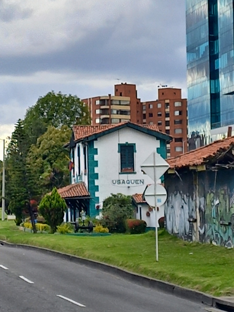
Since I knew that I would spend a Sunday in Bogotá, I adjusted my sightseeing plans so that on that particular day I would go to Usaquén, formerly an independent settlement and now a rather large part of the city north of the centre. Namely, this place is famous for its market that takes place in the centre of Usaquén every Sunday.
In the previous sequel, I already wrote about how I got here and now I can only say that the Uber driver took me to Usaquén Park (Parque fundacional de Usaquén).
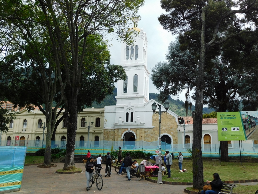
On the eastern side of this typical square-shaped urban square remaining from the colonial period stands the Church of St. Barbara (Iglesia de Santa Bárbara), dating back to 1665.
 Church of St. Barbara
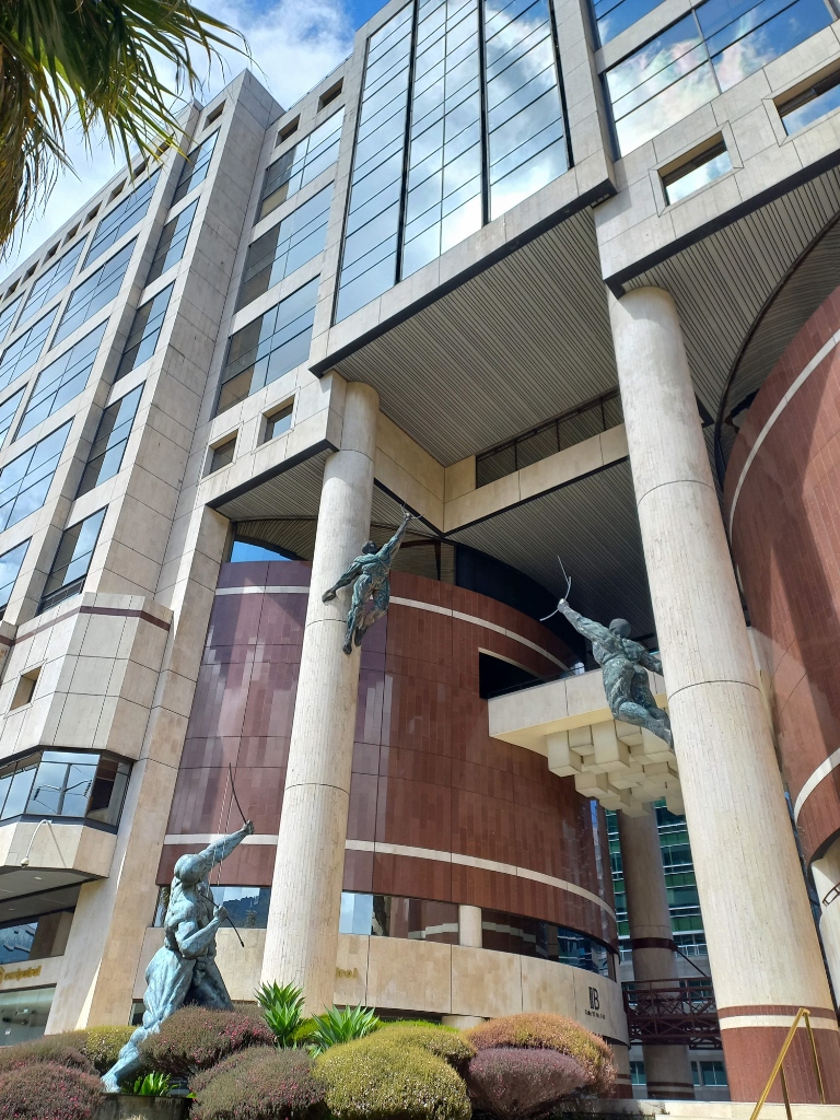
Considering my physical condition and the sensation of a significant lack of energy, while seeing the fence that was placed in the park, which meant I would have to go around to get to the church, I gave up on that idea and simply turned to the other side. There, I could see the Usaquén Town Hall (Alcaldía de Usaquén).
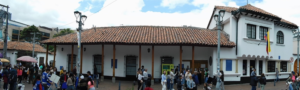 Usaquén Town Hall
I have already mentioned in the previous sequel of my travel story that Usaquén was originally a settlement of the Muisca people. Upon the arrival of the Spaniards, the indigenous people had some degree of semi-autonomy, but this was lost by the end of the 18th century, while Usaquén continued to function as a typical colonial town. This persisted until 1954 when it officially became part of the capital city of Bogotá.
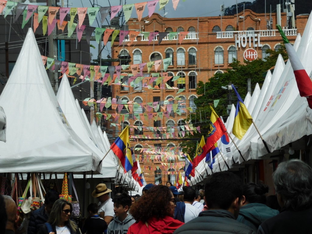
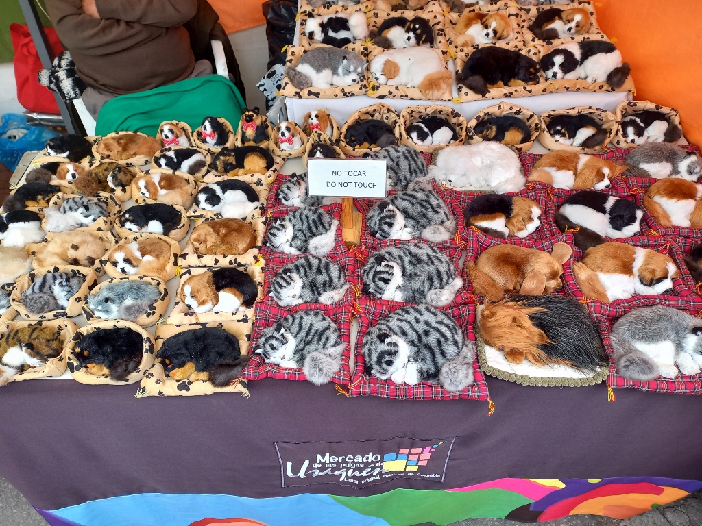
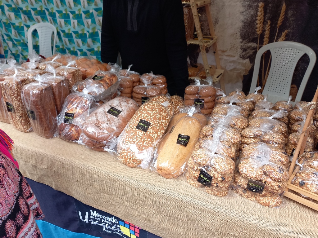
As for the "market," it is continuously and everywhere referred to as a "flea market" (mercado de las pulgas), but it is not a flea market in the true sense of the word. I would rather say that there are artisanal galleries whose artists and craftsmen set up stalls on Sundays to exhibit and sell their goods. There were extraordinarily beautiful things there; the only problem is that I don't like to shop. However, I immensely enjoyed the sights. What was particularly striking were the vivid colours.
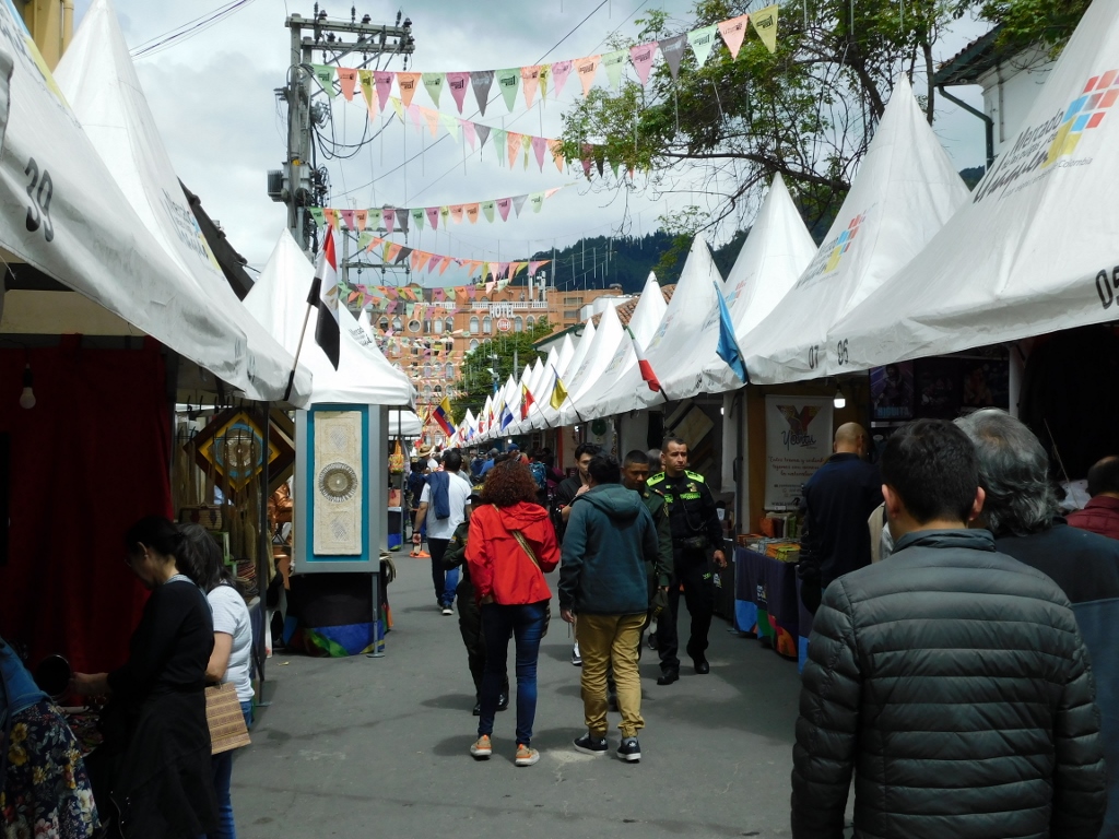 Usaquén Flea Market
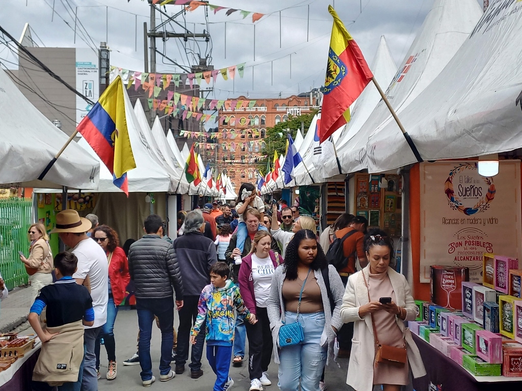 Usaquén Flea Market
 Usaquén Flea Market, a detail
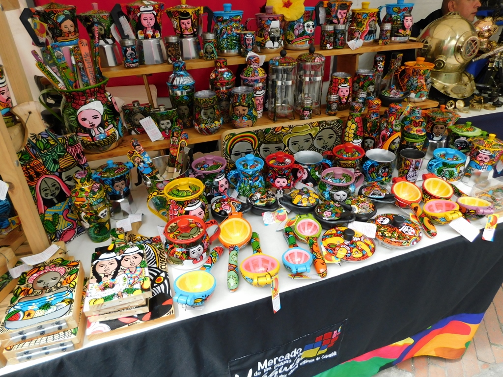 Usaquén Flea Market, a detail
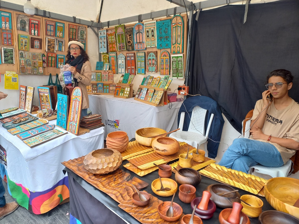 Usaquén Flea Market, a detail
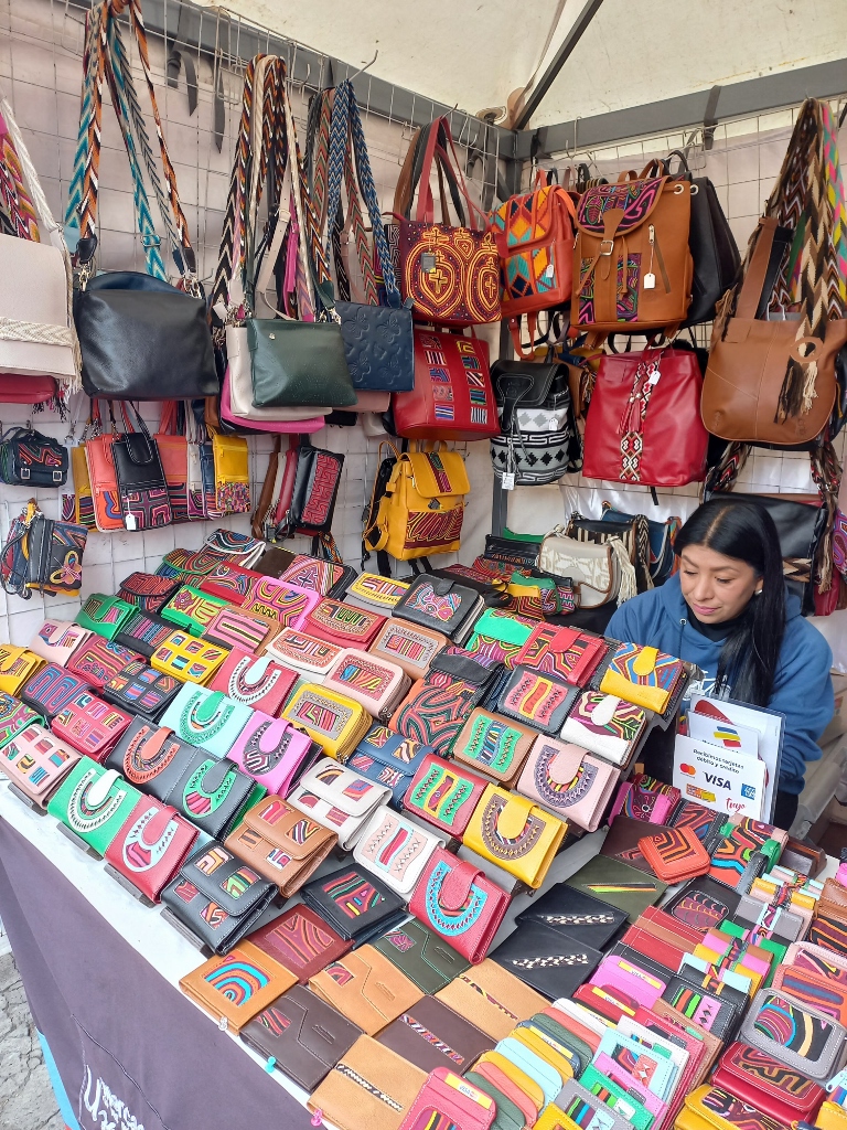 Usaquén Flea Market, a detail
 Usaquén Flea Market, a detail
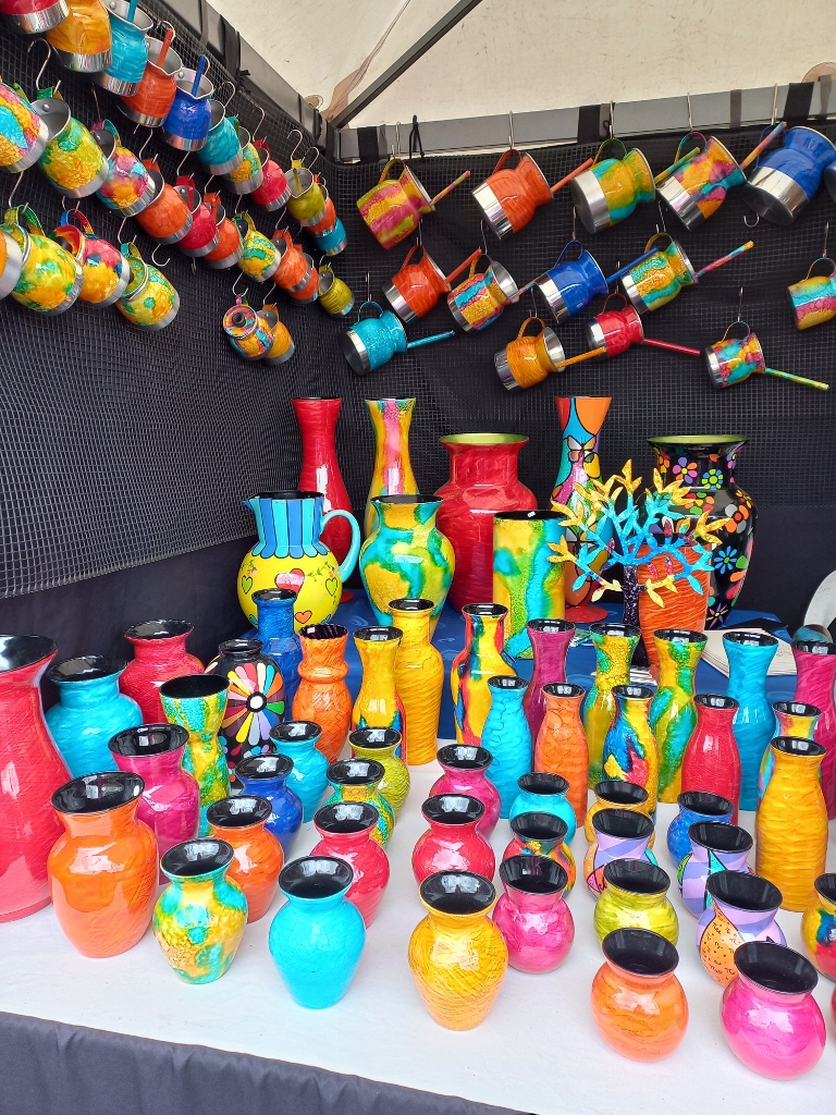 Usaquén Flea Market, a detail
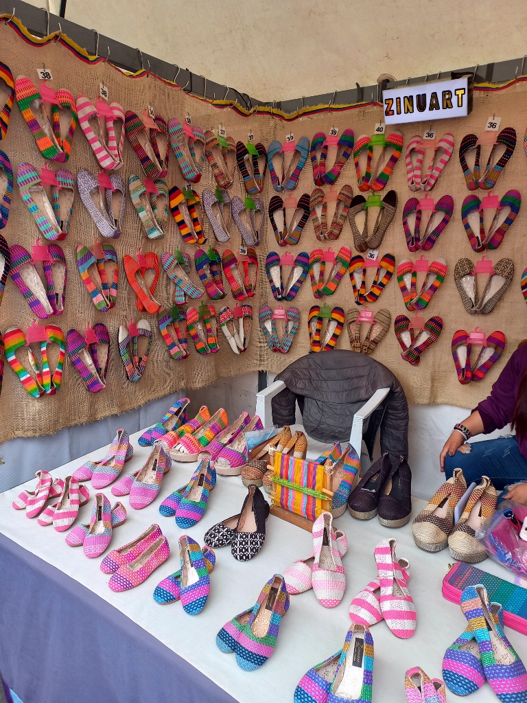 Usaquén Flea Market, a detail
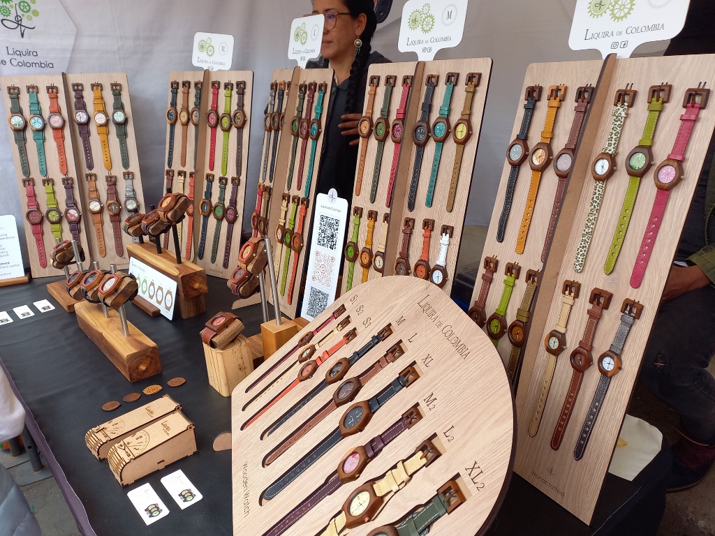 Usaquén Flea Market, a detail
However, at this market, not only skilfully made art and craft items are sold, but also food, spices, teas and similar goods.
 Usaquén Flea Market, a detail
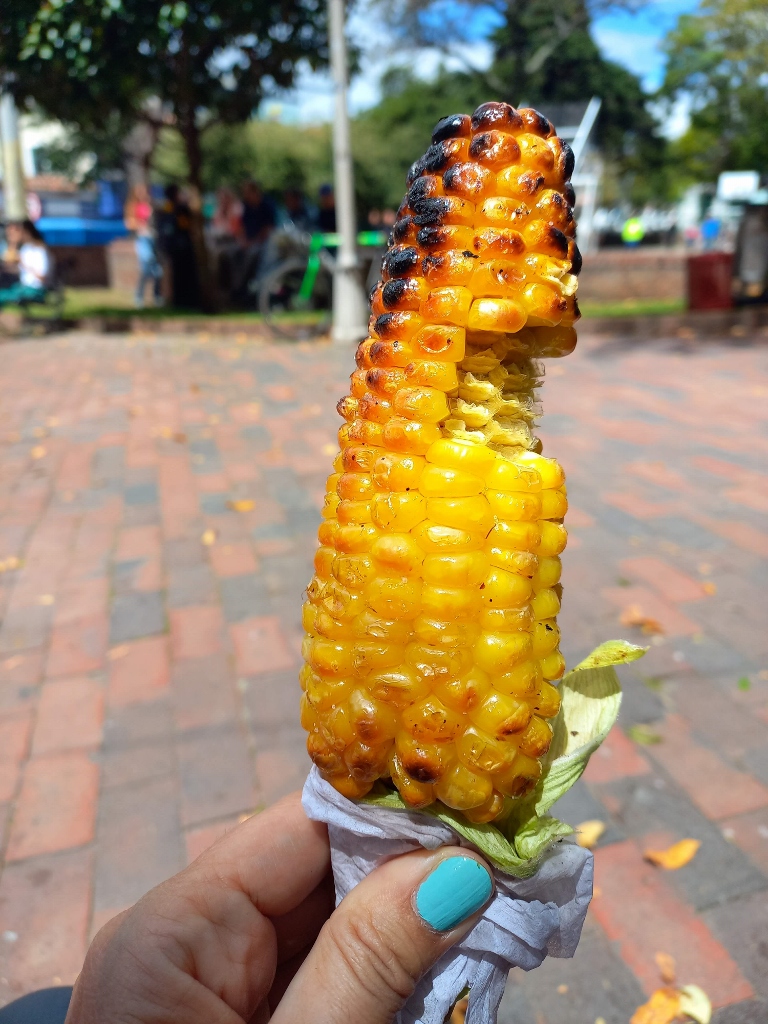
Speaking of food, I got inspired to try their roasted corn, which was sold in several places. It was good to try it, but I was not overly impressed because this was a very tough variety. Although corn (maize) originates from the Americas, over time much tastier and less tough varieties have been developed where I'm from. To eat this one in Usaquén peacefully without worrying it might slip from my hands, I sat comfortably on a bench in the park and, since I have good teeth, I managed to finish it there in the end.
 Break for a corn on the cob in the park
Then I continued with a leisurely walk in the opposite direction from the market.
 Usaquén
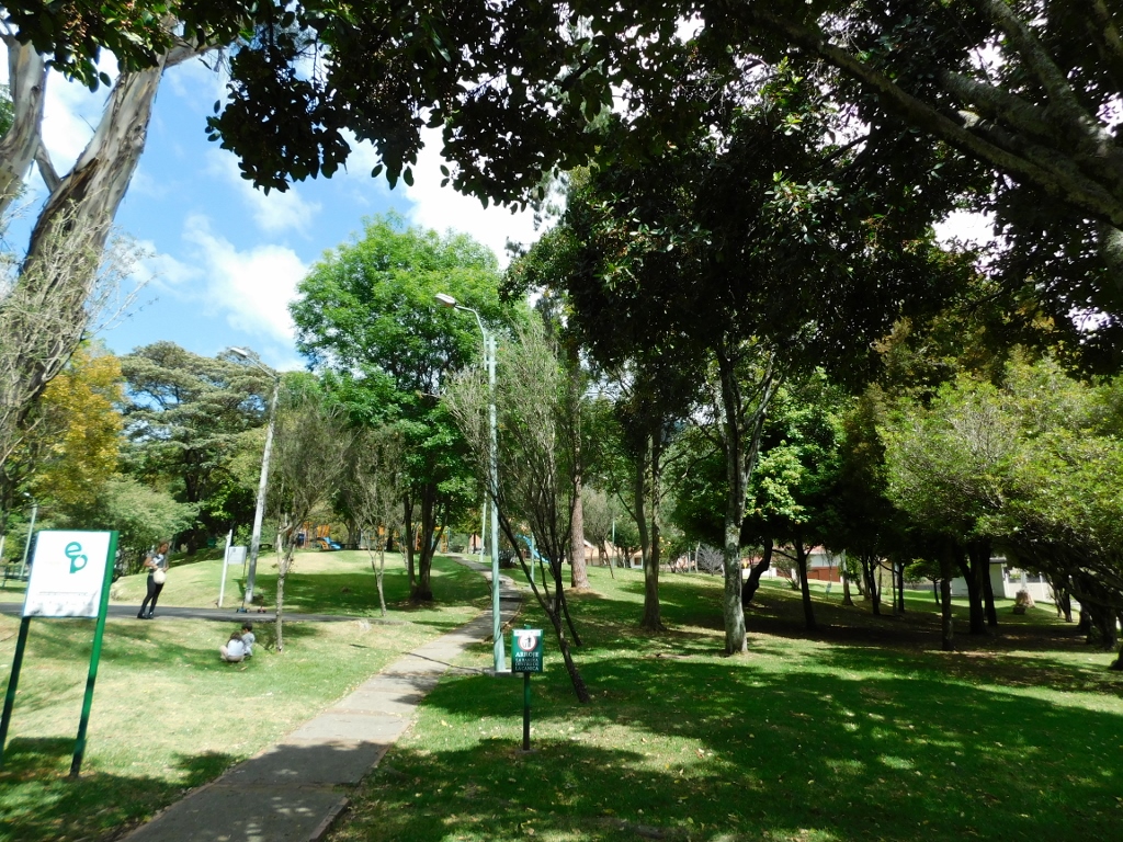
There were plenty of restaurants and cafes here, so at one point, I took a break to have lunch at a restaurant since the corn I had earlier wasn't quite enough. The break was refreshing, while afterwards I walked to a nearby park on a square-shaped plaza, just about 5 minutes away from the bustling market with stalls and visitors. It was a complete change – very peaceful and quiet.
 Hacienda Santa Barbara Park (Parque Hacienda Santa Barbara)
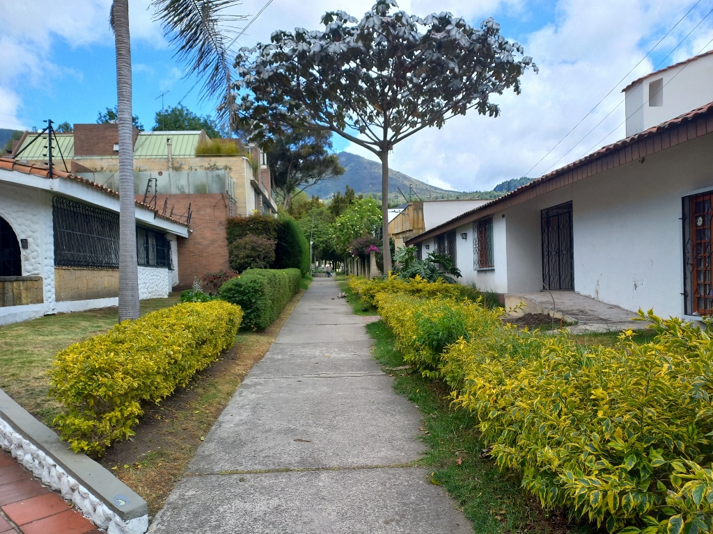
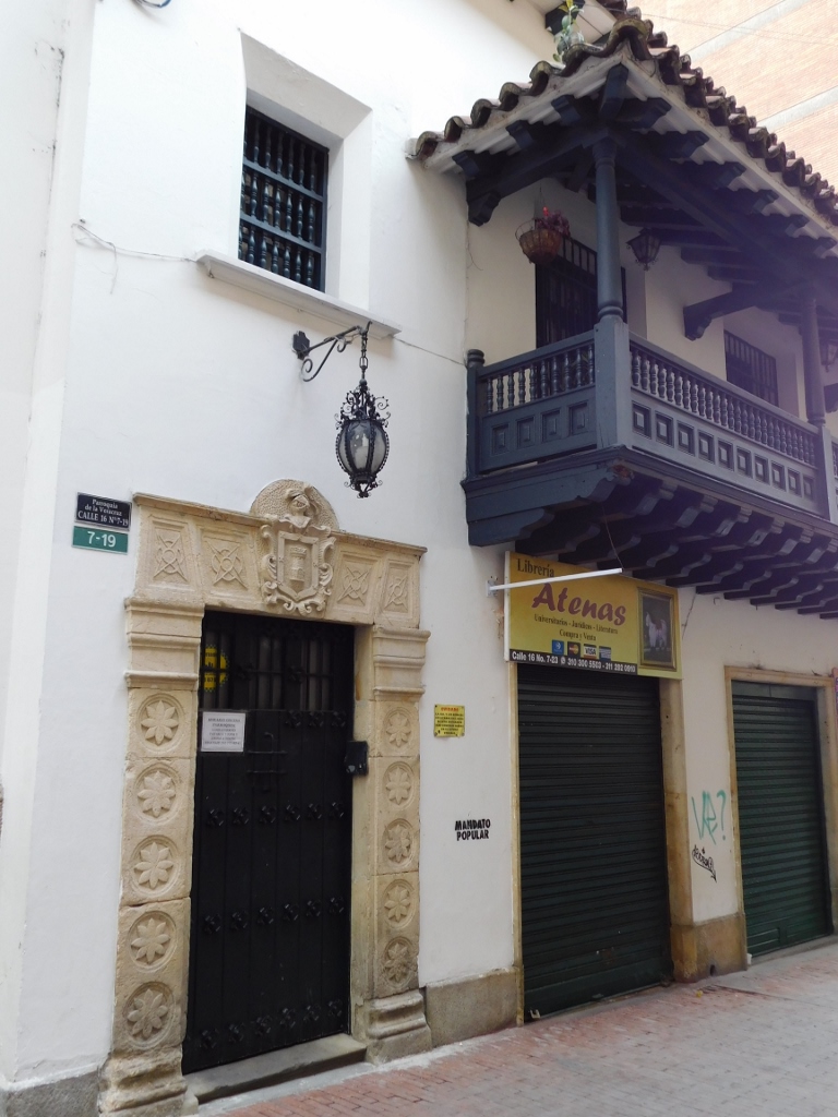
However, what left a specific impression on me were the beautiful and harmoniously built private houses I saw around the park and nearby. It seemed like a nice place for a quiet life. On the other hand, it was clear that all these single-story houses had metal grilles on the windows and doors, indicating that security is a significant concern in the area.
 Usaquén
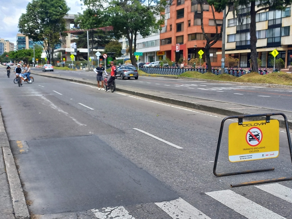
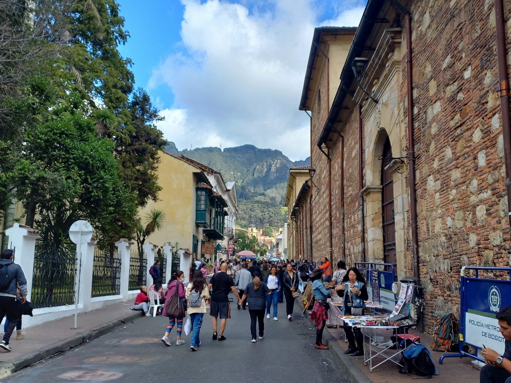
Soon I reached one of the main thoroughfares in Usaquén and indeed in all of Bogotá, which is Carrera 7. In a previous sequel, I mentioned the weekly closure of some streets to motor vehicles known as Ciclovía, a tradition that has been ongoing since 1974, marking 50 years! Carrera 7 is precisely the road that connects La Candelaria and Usaquén, allowing cyclists to travel safely on their bikes all the way from downtown Bogotá to here on Sundays.
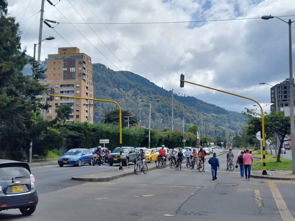 Ciclovia in Usaquén
 Ciclovia in Usaquén
By the way, if any visitors are wondering how to ride a bike around Bogotá on Sundays, here's a possible solution. I later captured this scene in downtown Bogotá, while these rental bikes are surely available at many different locations.
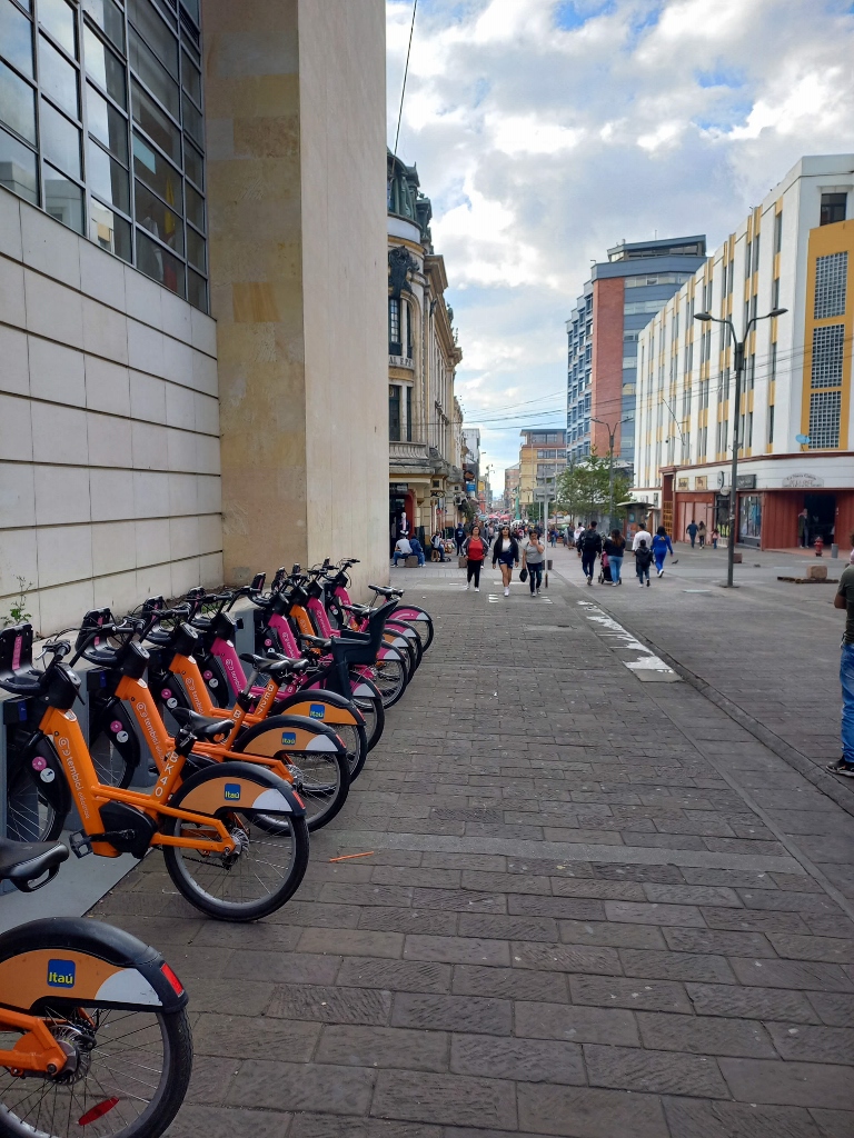 Rent-a-bike in Bogotá
Since I’m talking about recreation in Bogotá, as I passed through the city centre, I saw and filmed Recreavia on the plaza within Santander Park. It seems like it doesn't have a tradition as long as 50 years, but every beginning is tough.
But, let me return to my story about Usaquén. So, when I reached the main street, Carrera 7, I practically transitioned from a quiet residential area into a modern area with buildings that I assume are intended for commercial purposes.
 Usaquén, a detail
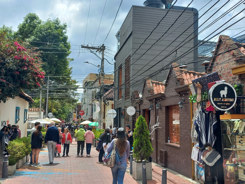
Besides the famous flea market, Usaquén today actually represents a beautiful blend of colonial and modern architecture, making it worth visiting even on days other than Sunday.
However, I was now ready to return to the centre of Bogotá, so I called Uber again. I had to wait a bit, so I captured more interesting scenes along the way. In the next photo, you can see another modern building alongside an old house in a state of decay.
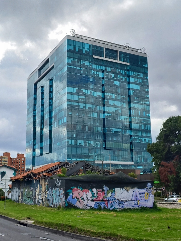 Usaquén, a detail
However, while I was taking these photos, I noticed further down from this decaying house another interesting and significant building: the Usaquén train station. As I was waiting for transportation and didn't have time to go closer and take a better photo of the train station, here's a snapshot nonetheless.
 Usaquén, a detail
Besides buses, taxis or bicycles, you can also reach Usaquén by a special train called the "Tourist Train" (Tren Turístico). This option is ideal for train enthusiasts, although it's not very practical. From what I've read, the ride itself is interesting. The tourist train operates on weekends and public holidays, stopping not only at Usaquén but also at Zipaquirá, which I've already written about (https://svudapodji.com/en/colombia-5/).
When my Uber ride arrived, I settled comfortably inside and soon enough I was at Plaza de Bolívar.
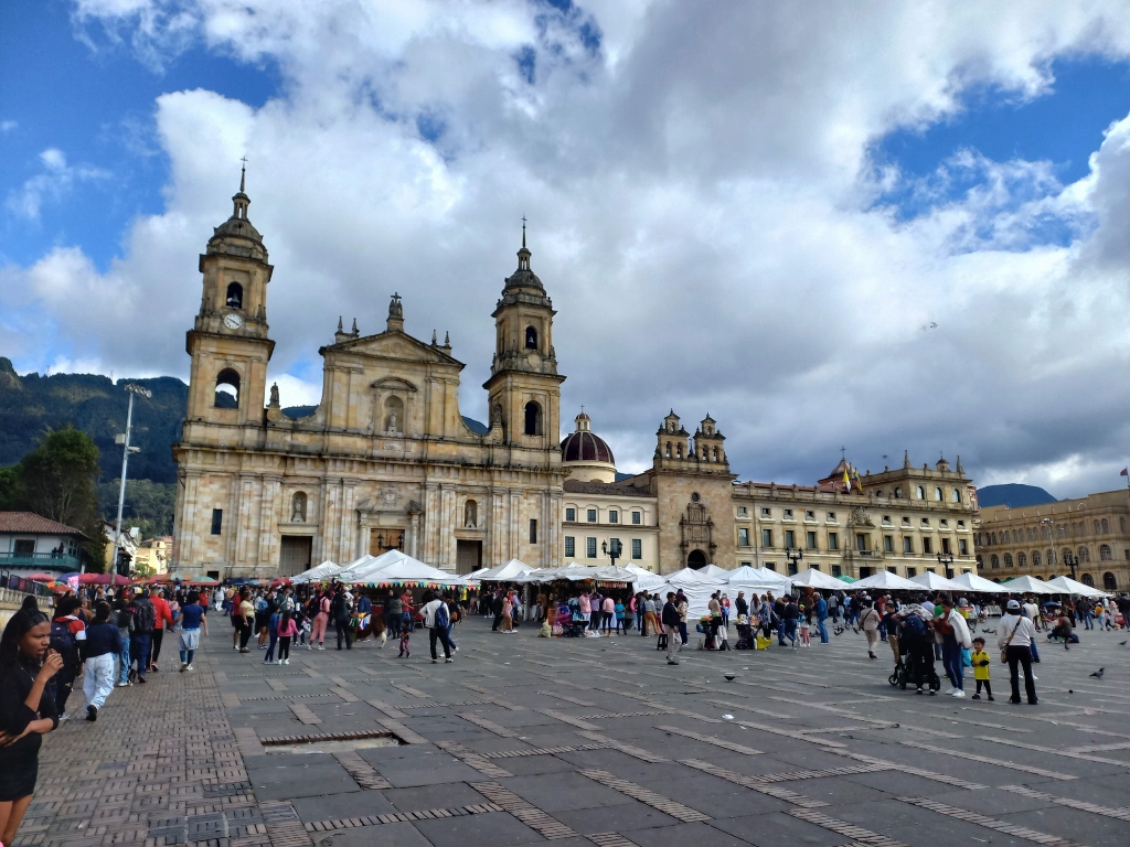 Plaza de Bolívar
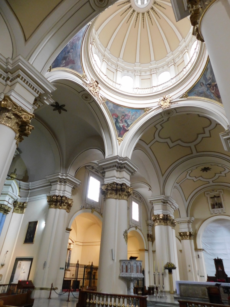
I noticed that the doors of the cathedral were open, so I realised that I hadn't actually visited it yet. Therefore, I went inside and explored it now.
 Cathedral, the interior
The cathedral was erected on the site where the founder of the city, Gonzalo Jiménez de Quesada, celebrated the first mass in Bogotá in 1538. Initially, a makeshift chapel was constructed for this purpose, but the construction of a permanent church began in 1553. However, its roof collapsed, so the church was only completed in 1590. This building also faced misfortune, however, as it was practically levelled to the ground in the earthquake of 1785, with only a few minor parts surviving. These surviving parts were incorporated into the new church, construction of which began in 1805, and this is the very building that stands here today.
 Cathedral, the interior
Several significant historical figures are buried in the cathedral, including the city's founder, Quesada, whose remains were transferred there in 1938.
 Cathedral, the interior
After exploring the interior of the cathedral, I emerged once again onto Plaza de Bolívar, where this Sunday afternoon, there were many people and a few llamas being used for taking pictures with tourists.
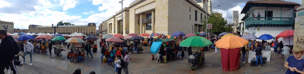 Plaza de Bolívar
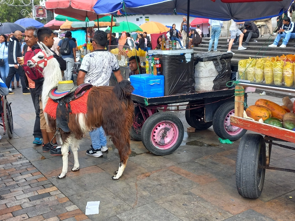 Plaza de Bolívar, a detail
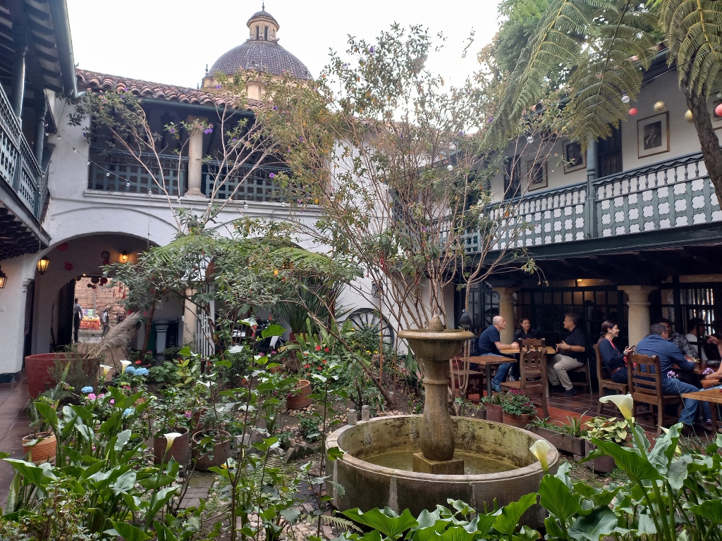
I didn't have a photo of me with the llama taken, but I continued with a leisurely walk and then went for coffee and cake at a nearby restaurant that has a couple of beautiful inner courtyards.
 Bogotá, a detail
 Bogotá, a detail
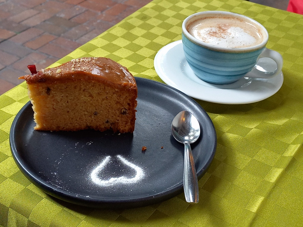 Nice coffee and cake break
Since I was feeling better by this point, I thought I might visit another building designed by Rogelio Salmona, which is part of the group of buildings on UNESCO's Tentative List of World Heritage Sites. Having seen three of his buildings already, I had a clear idea of his style, but I was curious if this fourth one followed the same concept.
I consulted my phone again to find out where I could catch a bus that would take me there quickly. I went to the station, but there was actually no station at the designated spot. It made me realise that while you can rely on internet information at times, it can often be unreliable. I considered walking since it wasn't far, but decided against it to avoid further exhaustion. Given my upcoming travels, it was important to stay fit and recover quickly, knowing the building would be there when I returned to Bogotá.
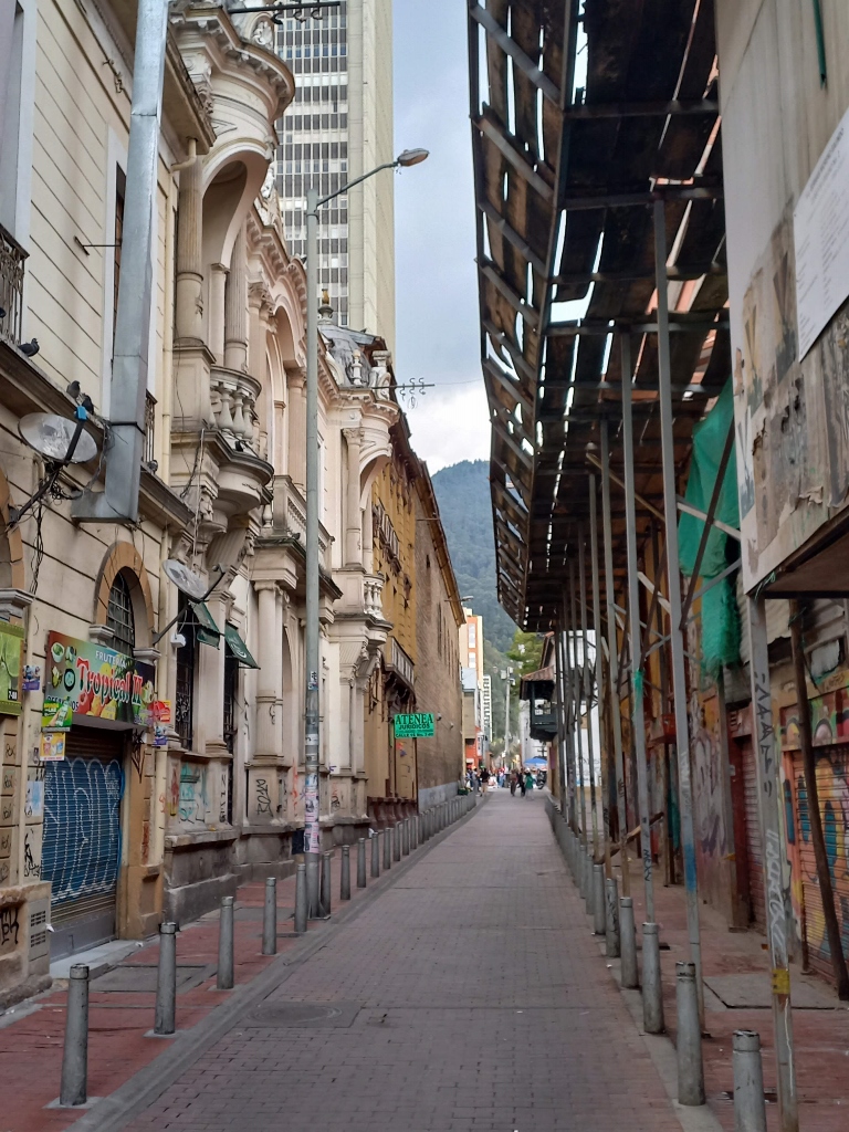
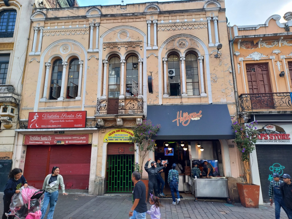
Therefore, I started to slowly make my way back towards the hotel, taking side streets along the way, which often proved very interesting. For instance, I stumbled upon a book vendor who not only sold books from his stall but also had installed speakers and was singing with great passion.
I also occasionally felt the need to capture various details of Bogotá, especially different parts of streets or houses that caught my eye.
 Bogotá, a detail
 Bogotá, a detail
 Bogotá, a detail
Along the way, I bought another mango peeled and diced, and then I returned to the hotel. It was still daylight, but knowing the sun would soon set, I adhered to my usual practice when travelling through much of Latin America: retiring to my room unusually early.
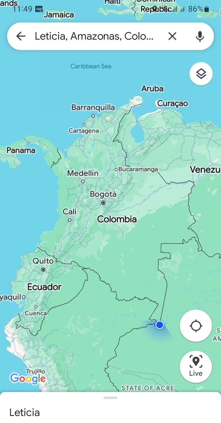
Furthermore, I needed to organise myself for the continuation of the journey, which was starting the next morning with an early flight to Leticia in the Amazonia.
Since my plan was to stay only four days in the Colombian Amazonia, I opted for a morning flight when purchasing my plane ticket from Bogotá to maximize my time there.
There are no roads leading to the Colombian Amazonia. While it's theoretically possible to reach Leticia, the southernmost and largest city in this region, by land, it would involve traversing through the jungle, navigating rivers and taking a significant amount of time. None of these options suited me, hence the choice of air travel. The distance between Bogotá and Leticia is nearly 1100 km and a large plane requires a full two hours to cover that distance.
Here is a map showing the places I visited during my stay in Colombia, including the location of Leticia.
In addition to the distance between Bogotá and Leticia, the fact that Bogotá is in the mountains and Leticia is in the plains, the altitude difference is also interesting – Bogotá averages around 2650 meters above sea level, while Leticia is only 96 meters above sea level.
I was very excited when I saw the Amazon through the airplane window.
 View at the Amazon from the plane
After landing at the airport in Leticia, I collected my luggage, hailed a taxi and soon arrived at the guesthouse I had booked for the day.
Here is a short video that partially illustrates what this part of the city looks like.
Upon arriving at the guesthouse, I used my mobile phone to capture my location and sent it to friends and family, which I found particularly interesting:
 Here I am!!!
Despite the change in altitude and increased humidity in Leticia, I didn't feel physically great and my cough persisted. So, upon arriving at the guesthouse, I asked the hostess to boil water for me to make tea that I had bought in Bogotá. It was soothing, but it didn't cure my cough.
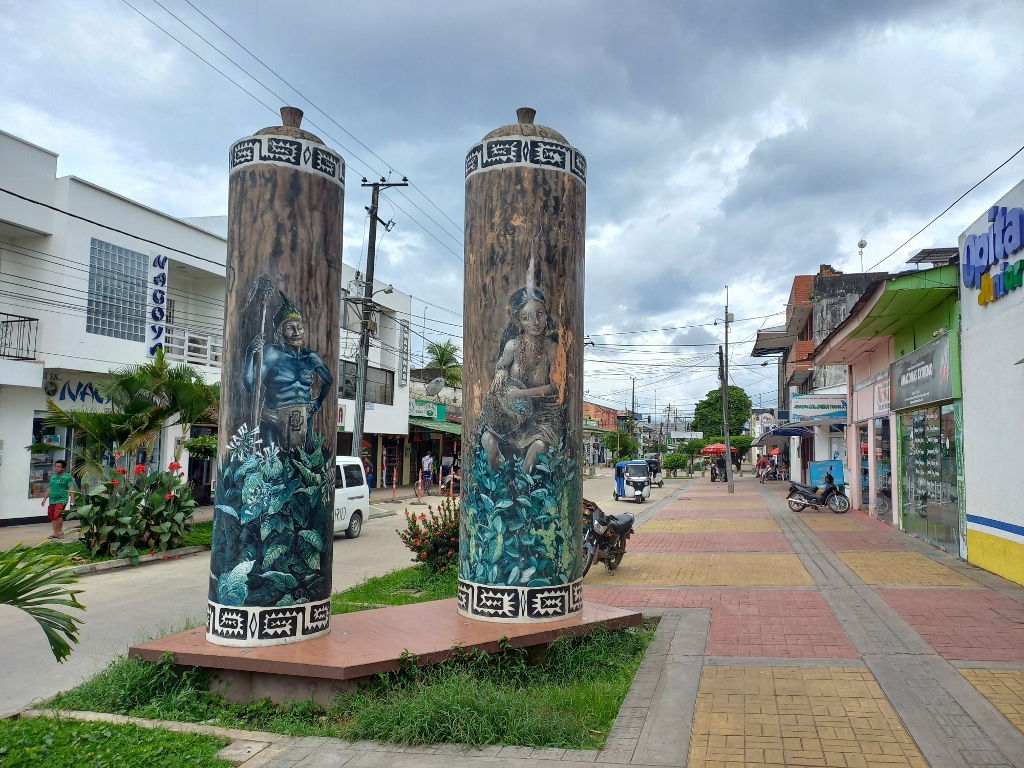
On the other hand, psychologically I was very content. After this short break, I decided to take a stroll around the city and also purchase a ticket for a boat ride for the next day.
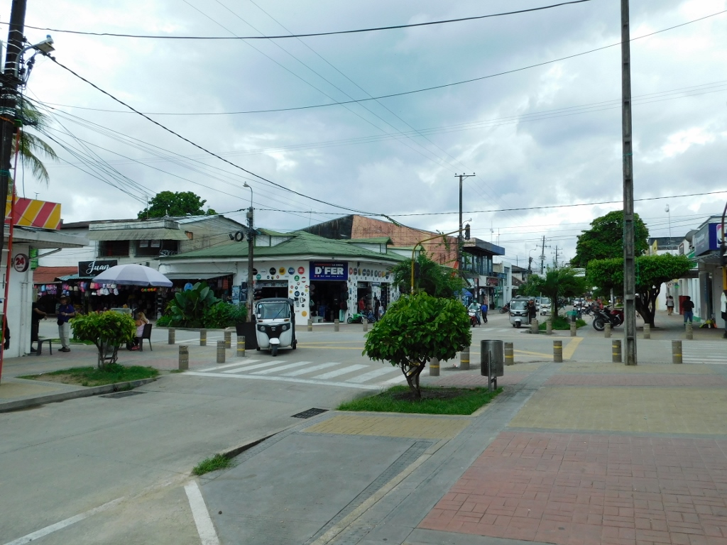 Leticia
On the way to the river port, I enjoyed interesting sights along the road, while I also reached a green market where I stopped to buy some fruit.
 Leticia
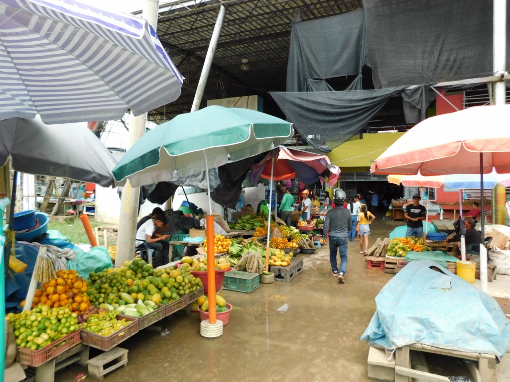 Leticia green market
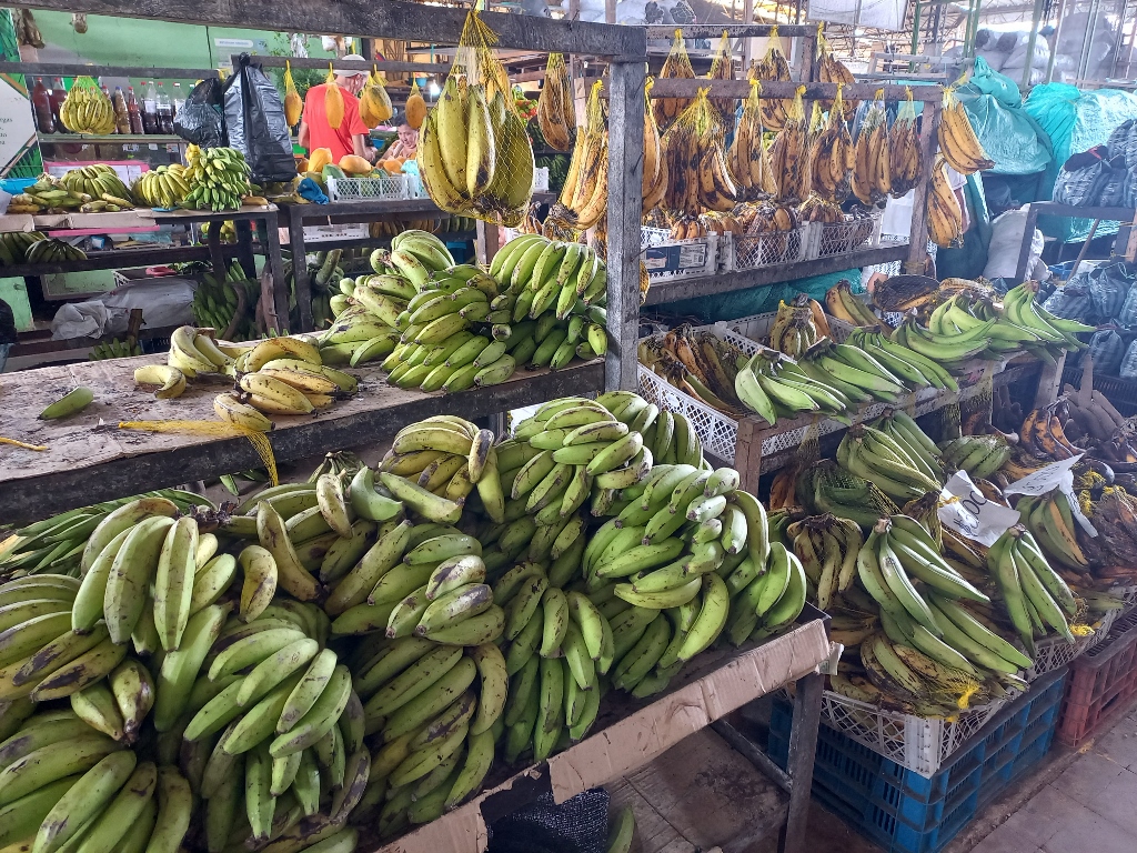 Leticia green market
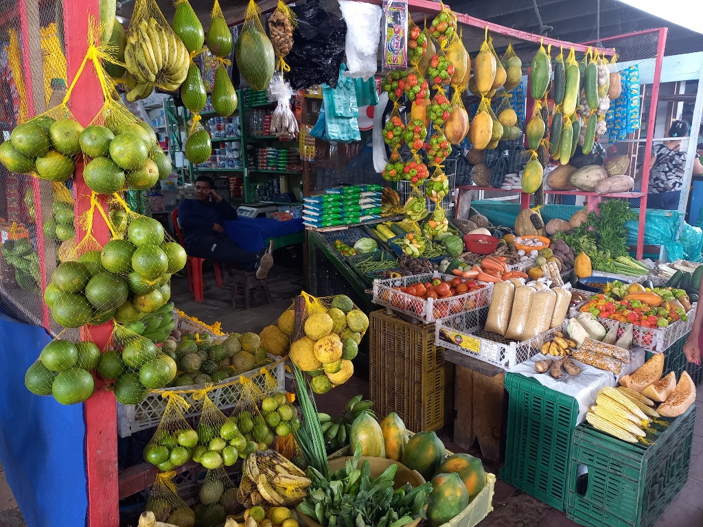 Leticia green market
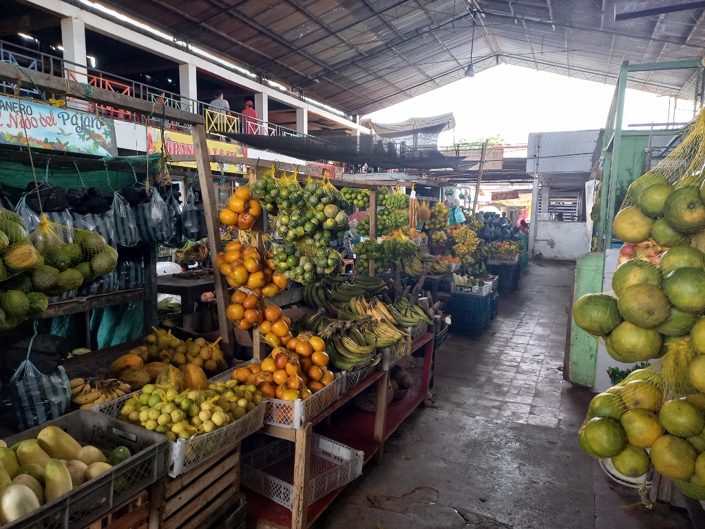 Leticia green market
Besides fruits and vegetables, the market also offered bags of charcoal and river fish for sale. After all, Leticia is located on the banks of the Amazon River.
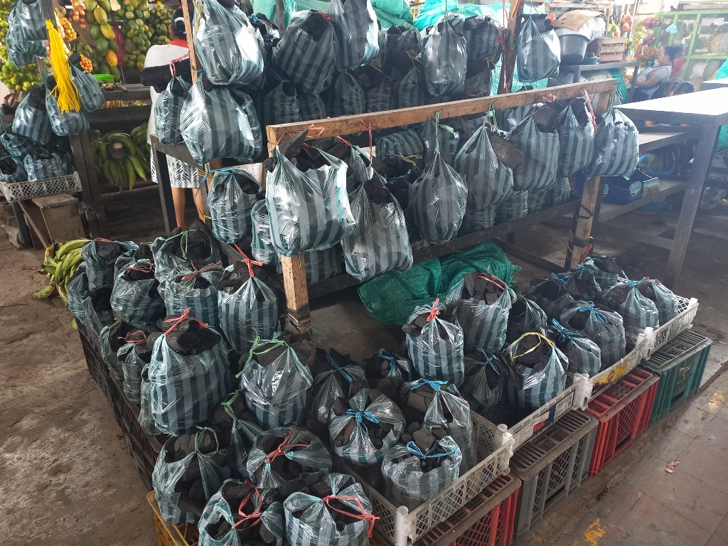 Leticia green market
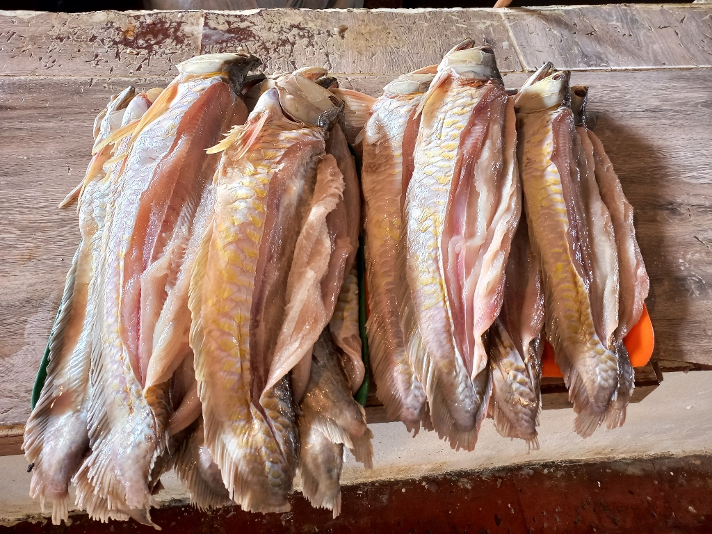 Leticia green market
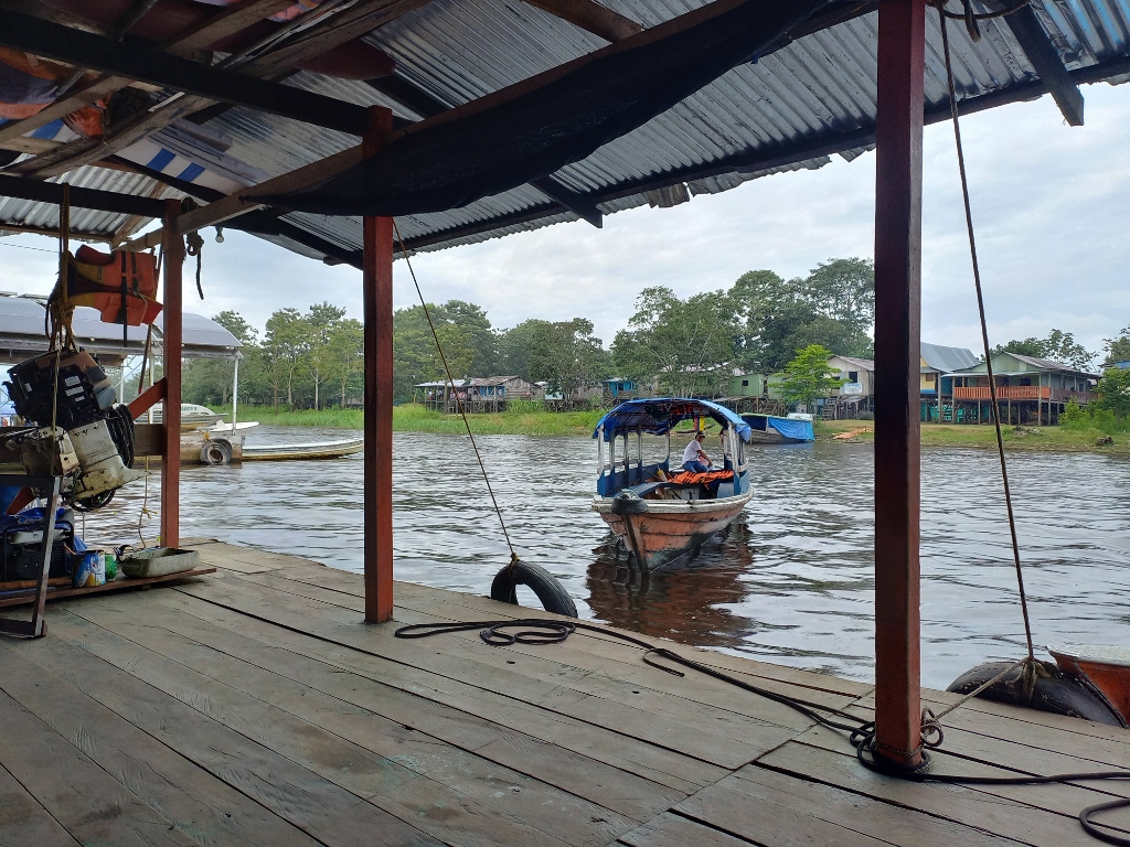
As for the Amazon, just a few dozen metres from the market there is an arm of the river where the river port is located.
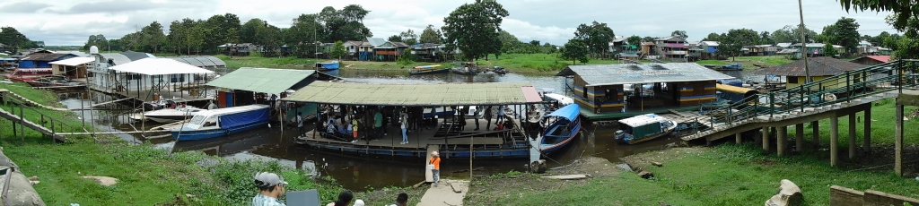 Leticia river port
I noticed there was a larger crowd on one of the rafts serving as a pier, but I was told that tickets needed to be purchased at an office which turned out to be closed at that time. Therefore, I decided to return later and in the meantime, I took some photos of the port and its surroundings.
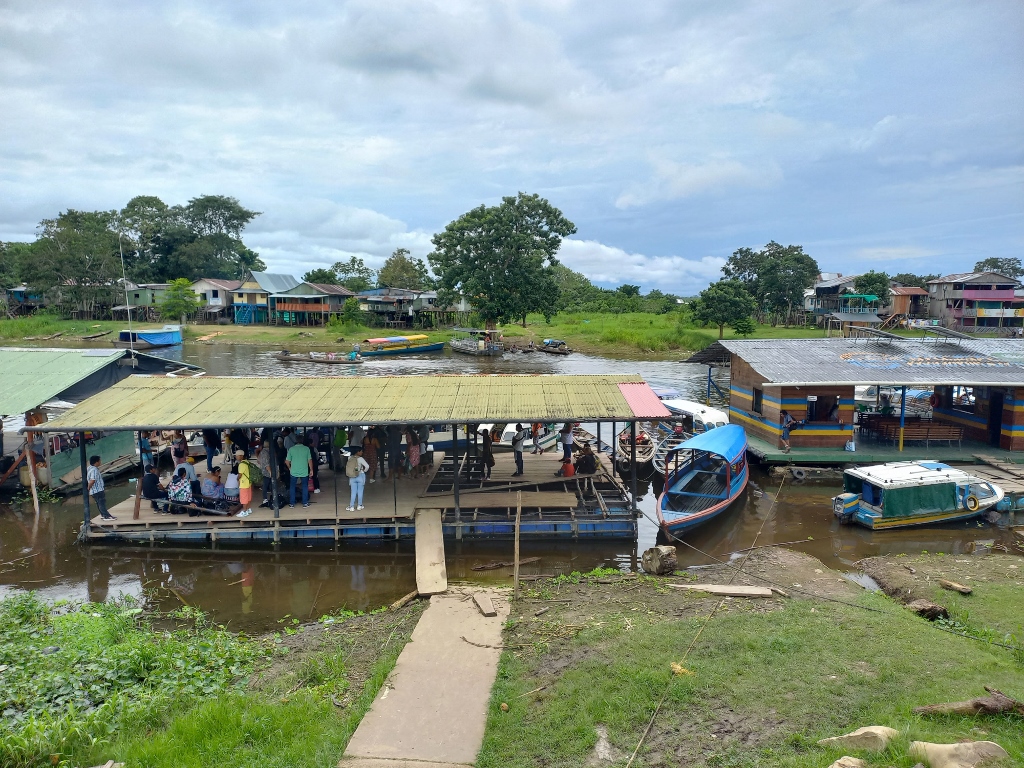 Leticia river port
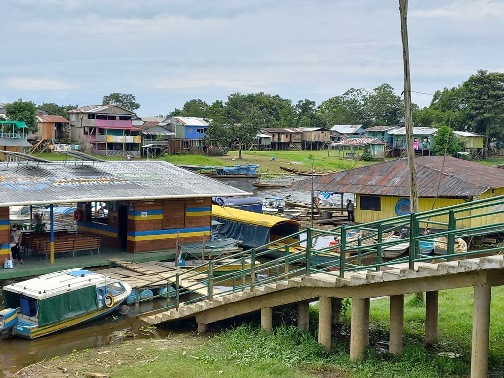 Leticia river port
As it can be seen, everything here is constructed either to float or is raised on stilts if the structure is more permanent. This is because the water level of the Amazon River varies significantly throughout the year. From what I've read, in some parts, the difference between the highest and lowest annual levels of the Amazon can be as much as 15 metres!!!
I was here in the second half of January, which is already during the rainy season, but the Amazon River level was still far from its highest.
Anyway, I was now ready to have lunch, so I decided it would be best to actually go to Peru for that! So, I headed down to one of the raft docks where I was supposed to take a boat to Santa Rosa de Yavarí Island, located on the right bank of the Amazon River and belonging to Peru.
 Waiting for the transportation to Peru