My journey through the Peloponnese in September 2023 was exceptional in every way. The landscapes, nature, the cultural and historical monuments, experiences, the weather... everything was perfect. However, in a way, all of this came to an end when I left the Peloponnese by car and crossed into the mainland of Greece. Admittedly, I still had a day and a half of travelling ahead of me, so my enjoyment wasn’t entirely over.
Although I had booked a room in a hotel in the town of Loutraki on the south-eastern coast of the Gulf of Corinth, first I just passed through the town and continued westwards along the coast. My goal was the famous sanctuary at the cape, about 20 km further on.
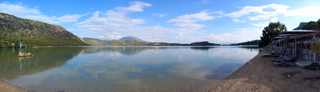
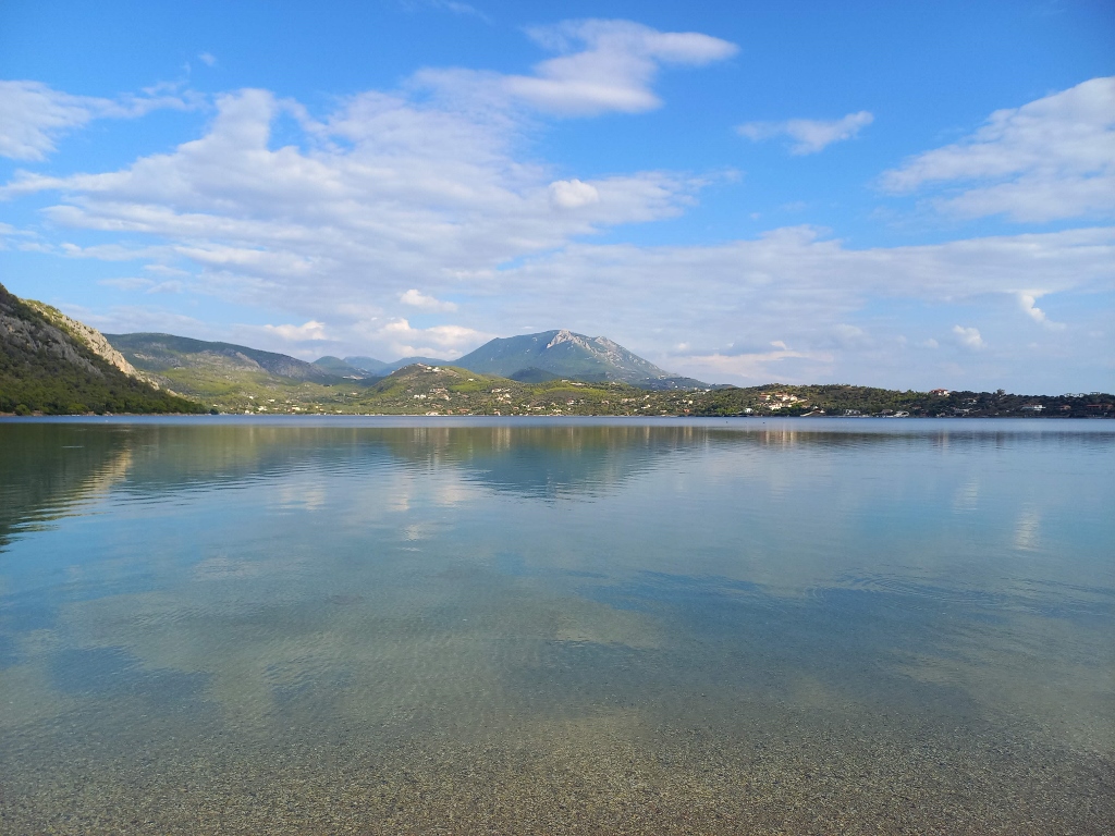
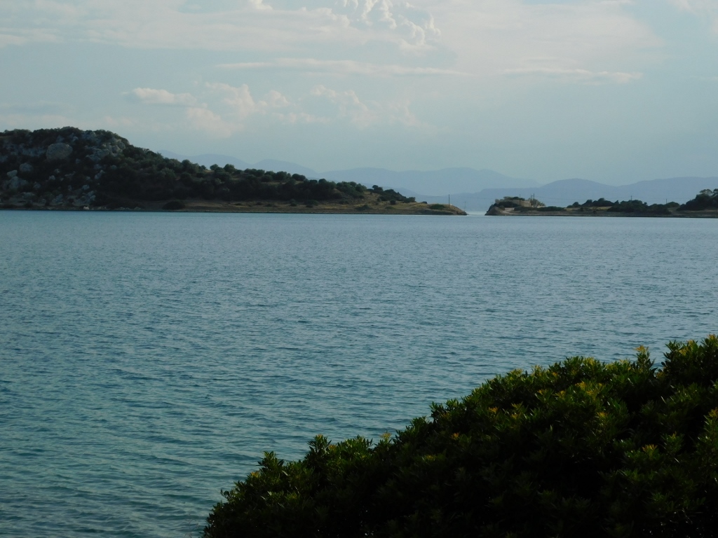
The road passed through some beautiful landscapes, though it wasn’t convenient for me to stop and take photos until I reached Lake Vouliagmeni. By the way, this lake, located in the Corinthia region, should not be confused with a lake of the same name in the Attica region, which I, incidentally, visited the following day.
To make everything clearer, here’s a map showing the places I visited during this trip:
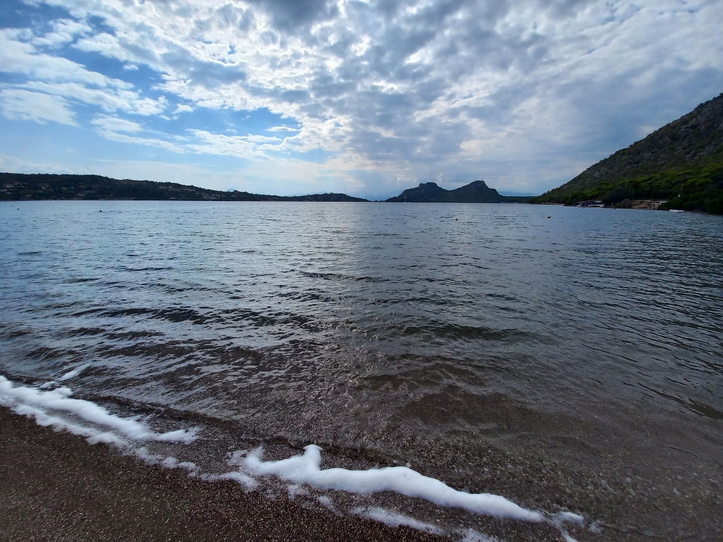
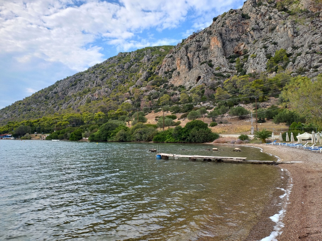
And as for Lake Vouliagmeni in the Corinthia region, here are a few pictures, as I briefly stopped at a restaurant there and ordered a refreshing drink. I was still feeling dehydrated from visiting Acrocorinth and Ancient Corinth.
 Lake Vouliagmeni in Corinthia region
 Lake Vouliagmeni in Corinthia region
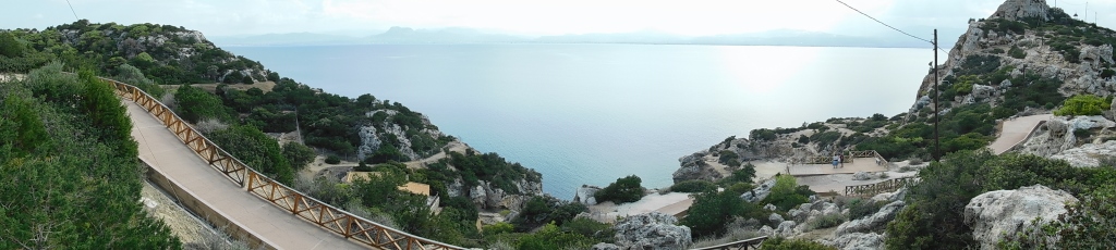
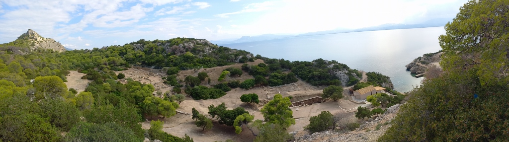
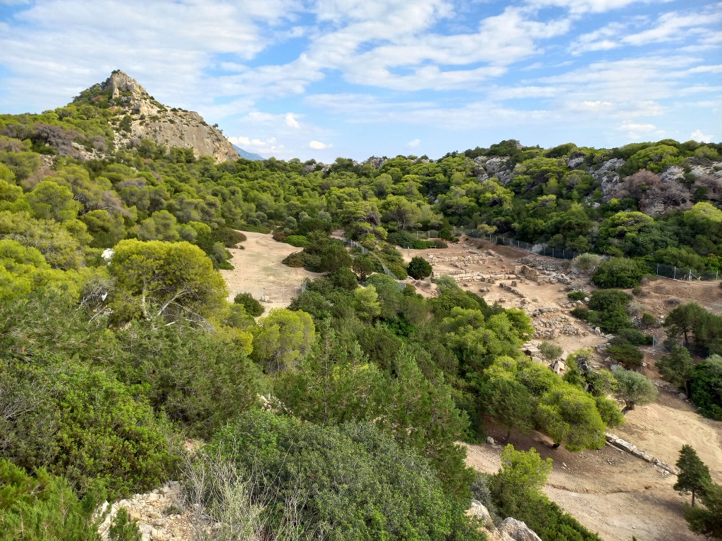
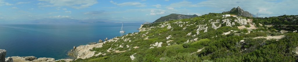
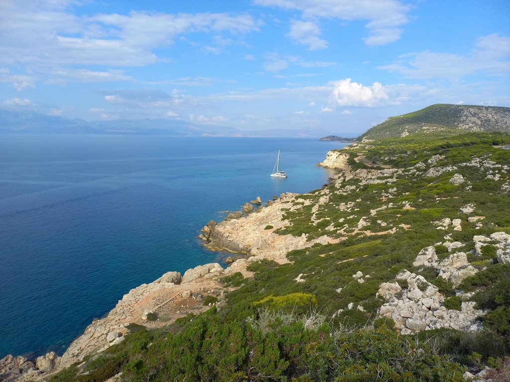
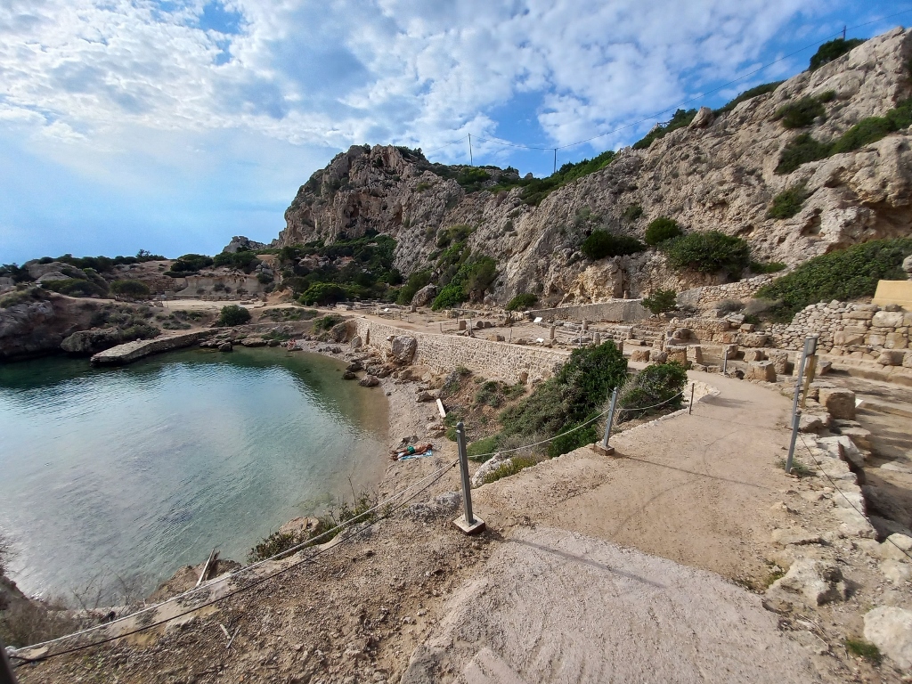
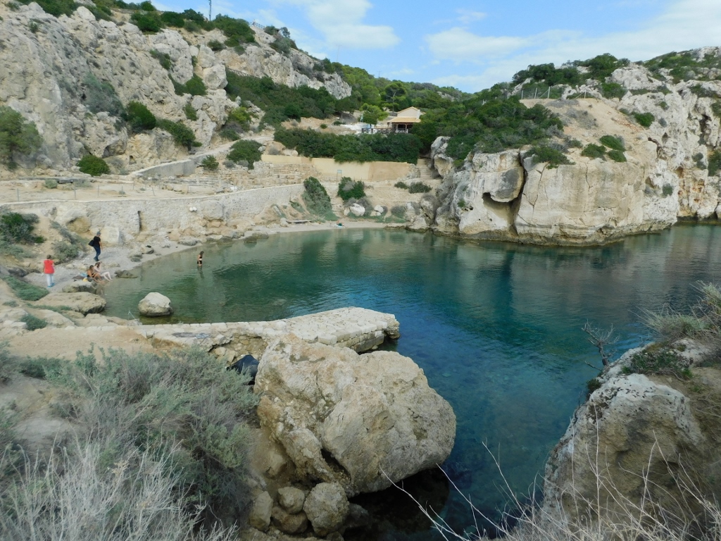
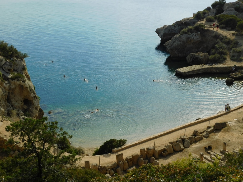
I didn’t stay here for long, but continued west to a place called the Archaeological Site of Heraion at Perachora. Perachora is a village the road passes through before descending to the lake, but the site is located on a small peninsula of the same name as the nearby settlement.
Although finds in this area show that people lived here as far back as the 3rd millennium BCE and that they had a very complex water supply system, the most important feature on the peninsula is undoubtedly the ancient sanctuary dedicated to the goddess Hera “of the heights” or Hera Akraia. (This “of the heights” is just an epithet added to the goddess’s name, much like in the case of the Mother of God in Christianity). The temple dedicated to the goddess is just one part of the archaeological site that can be visited here.
The road ends at the top of a hill, from where trails lead to various parts of the site and the shore in the shape of a small and exceptionally charming bay.
 Archaeological Site of Heraion at Perachora
 Archaeological Site of Heraion at Perachora
 Archaeological Site of Heraion at Perachora
 Archaeological Site of Heraion at Perachora
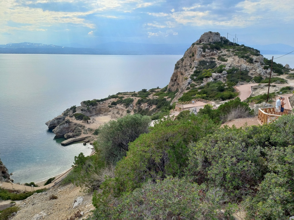
I am, to my great fortune, naturally programmed as a person capable of delaying gratification (at least for a short time). In this case, it meant that I didn’t immediately rush to the site and the beach, but instead first went to the end of the cape where a lighthouse is located, which is behind the pointed elevation in the upper right part of the previous photo.
This also allowed me to have a nice view of the site and the beach, but from a different angle, while also I reached the lighthouse soon.
 Archaeological Site of Heraion at Perachora
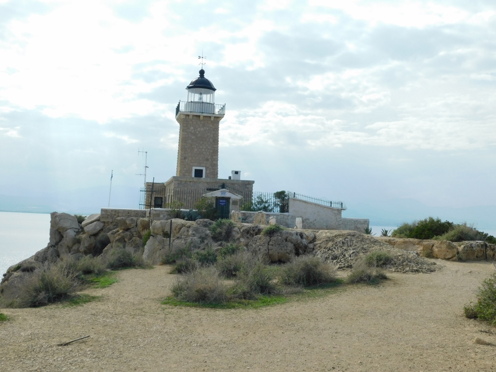 Lighthouse at Perachora peninsula
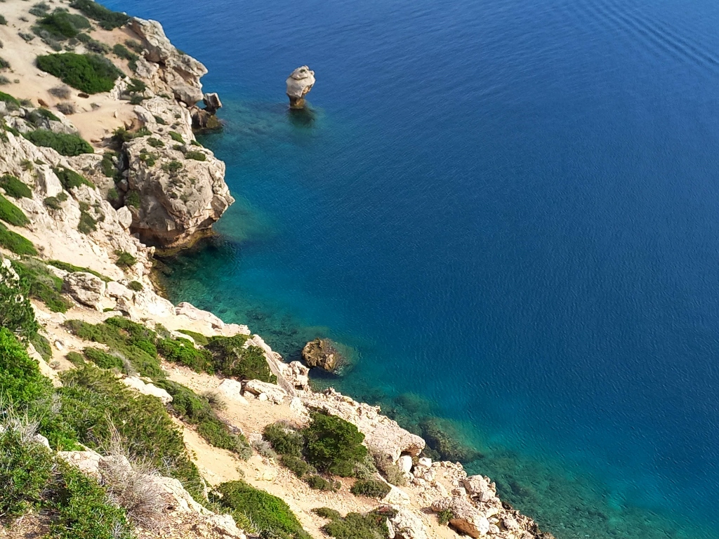
From there, I could also see the other coast of the peninsula, which may not have archaeological remains, but it certainly has beauty.
 Perachora peninsula
 Perachora peninsula, a detail
It was also nice to look "below" me, at the beautiful waters of the Gulf of Corinth.
 Perachora peninsula, a detail
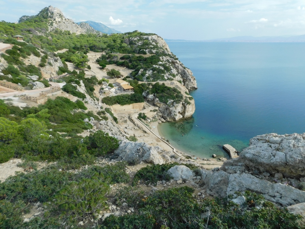
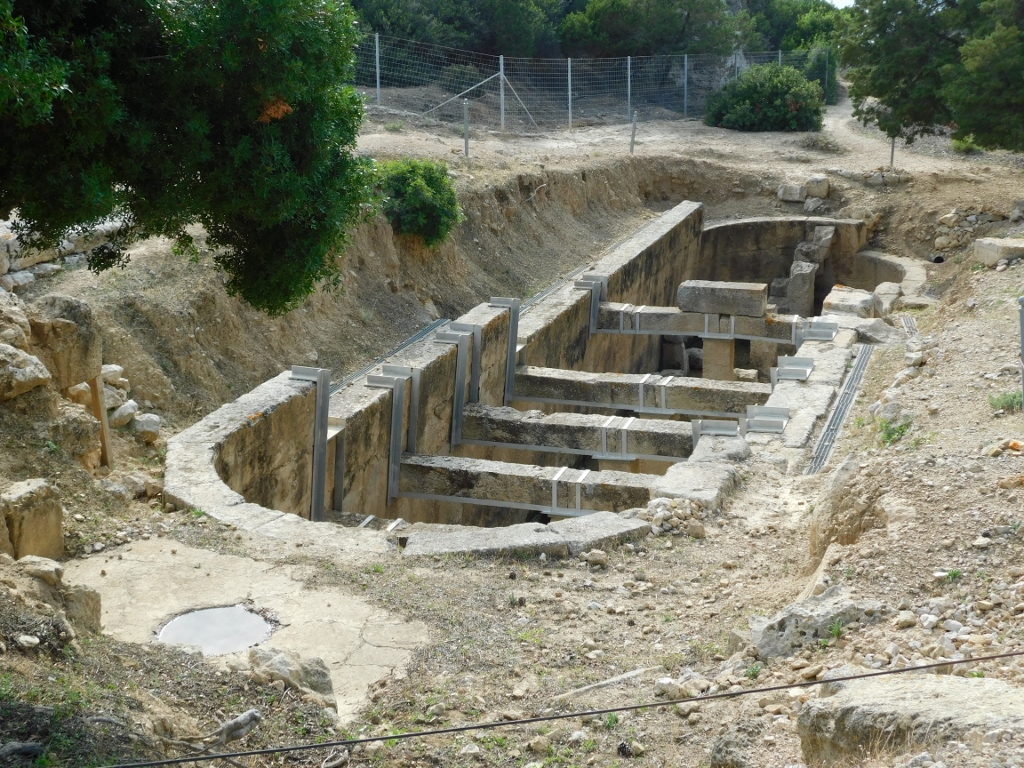
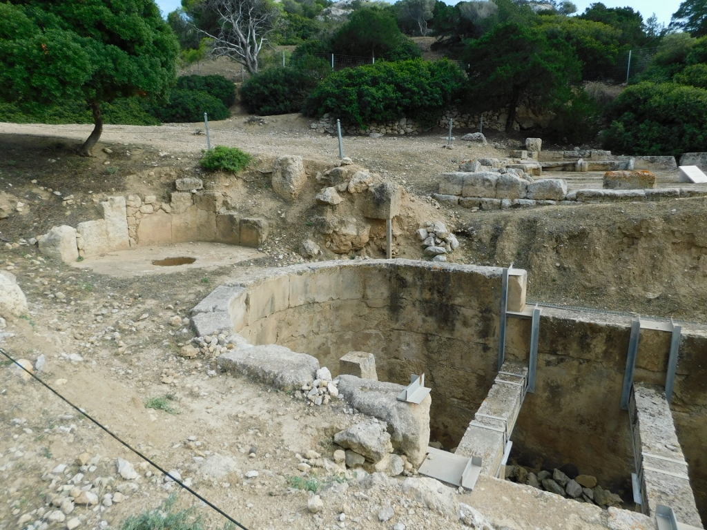
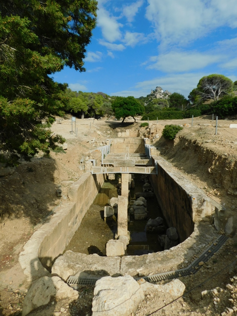
But, I came here to explore the remains of the ancient sanctuary, so I headed towards it. From the height, I was able to clearly see some details, like the West Court and the former Harbour, which is now a small bay, attractive to those who want to swim there.
 Archaeological Site of Heraion at Perachora, a detail
 Archaeological Site of Heraion at Perachora, a detail
The sanctuary was founded in the 8th century BCE, reaching its peak in the 6th century BCE. It was dedicated to Hera of the Heights, Hera Akraia, and is often also referred to as Limenia, meaning "of the harbour," resulting in the name Sanctuary of Hera Akraia-Limenia, i.e., "Hera of the Heights of the Harbour." I mention this because all these names are associated with the site, but it's also enough just to refer to it as Heraion at Perachora.
The sanctuary was built on a slope in three levels, with the temple located at the lowest level, next to the harbour. It was a Doric temple constructed in the 6th century BCE.
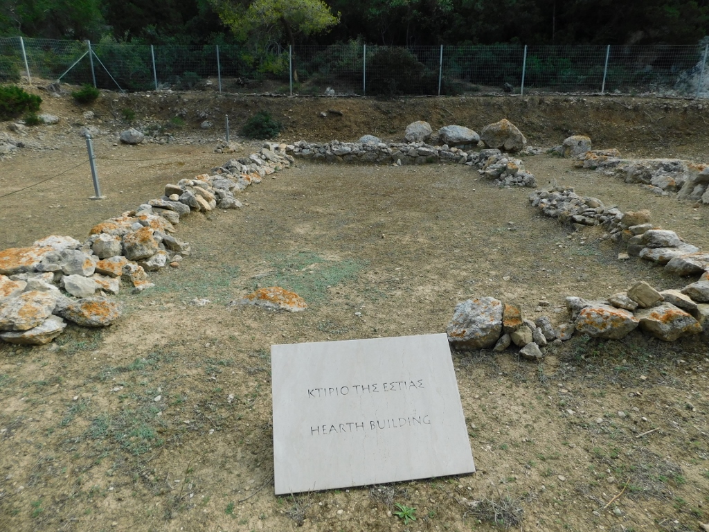
However, I started from the highest section and so I first went to the remains of the ramparts, where I also found the remains of the Hearth Building from the 7th century BCE that is believed to have served as a ritual dining hall for official visitors to the sanctuary.
 Archaeological Site of Heraion at Perachora, a detail
 Archaeological Site of Heraion at Perachora, a detail
Here, I also observed and photographed a spotted flycatcher (Muscicapa striata), so here it is:
 Spotted flycatcher
As for the site, further down the slope, the remains of a very impressive Apsidal Cistern can also be seen.
 Archaeological Site of Heraion at Perachora, a detail
South of the cistern are the remains of a building called the Hestiatorion, which refers to a "banquet hall" or a ceremonial dining-room.
 Archaeological Site of Heraion at Perachora, a detail
 Archaeological Site of Heraion at Perachora, a detail
Now I descended to the lowest section that extends around the small bay where the harbour once belonging to the sanctuary was located.
 Archaeological Site of Heraion at Perachora, a detail
First, you come across the remains of a former stoa from the 4th century BCE, which had two storeys. However, I found it more interesting to focus on the Altar and then on the remains of the Temple of Hera.
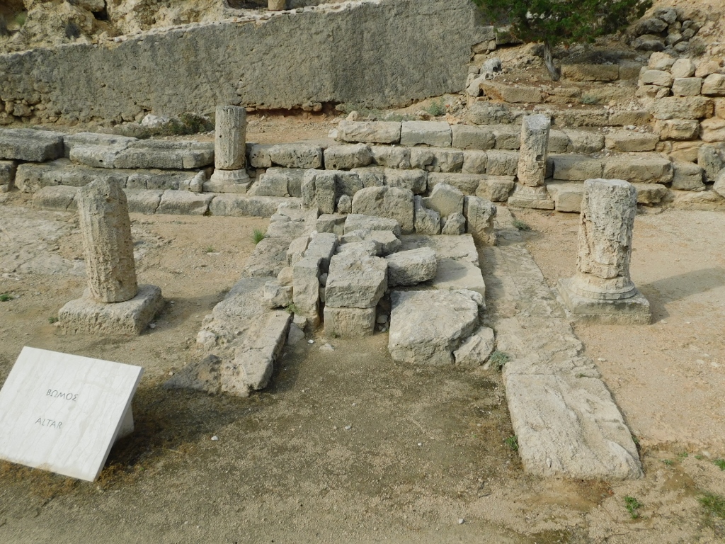 Archaeological Site of Heraion at Perachora, a detail
 Archaeological Site of Heraion at Perachora, a detail
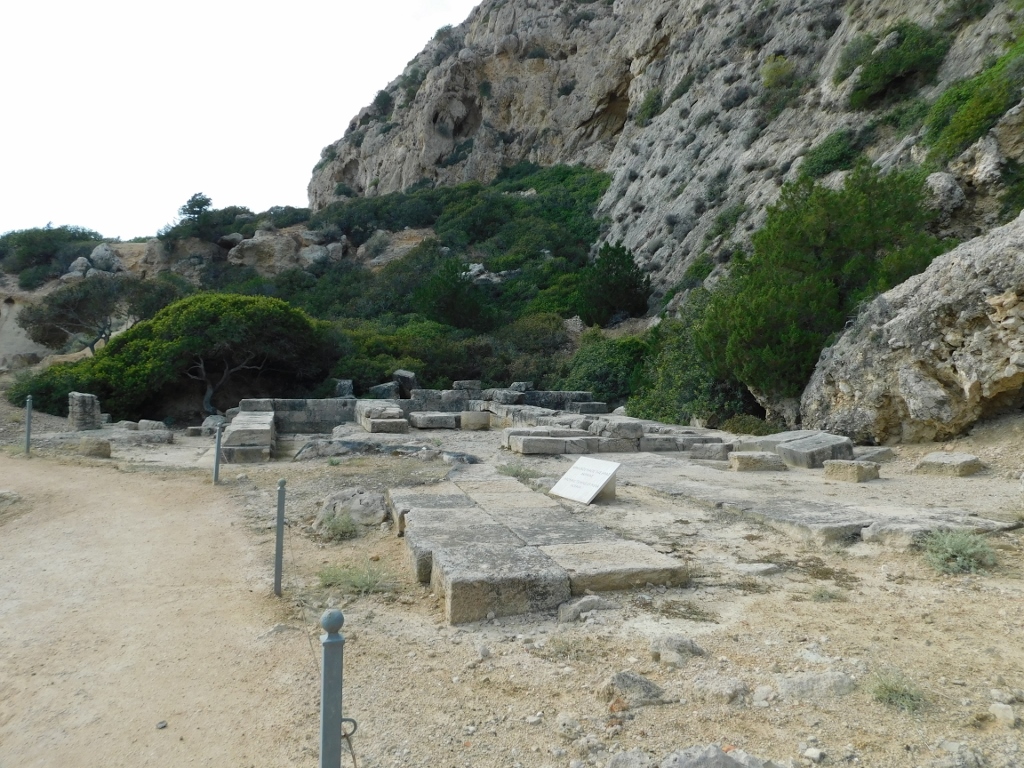
Next is a flat area called the West Court, where the remains of a Roman house can also be found. Since I’m mentioning the Romans, it’s worth noting that they destroyed the sanctuary in 146 BCE.
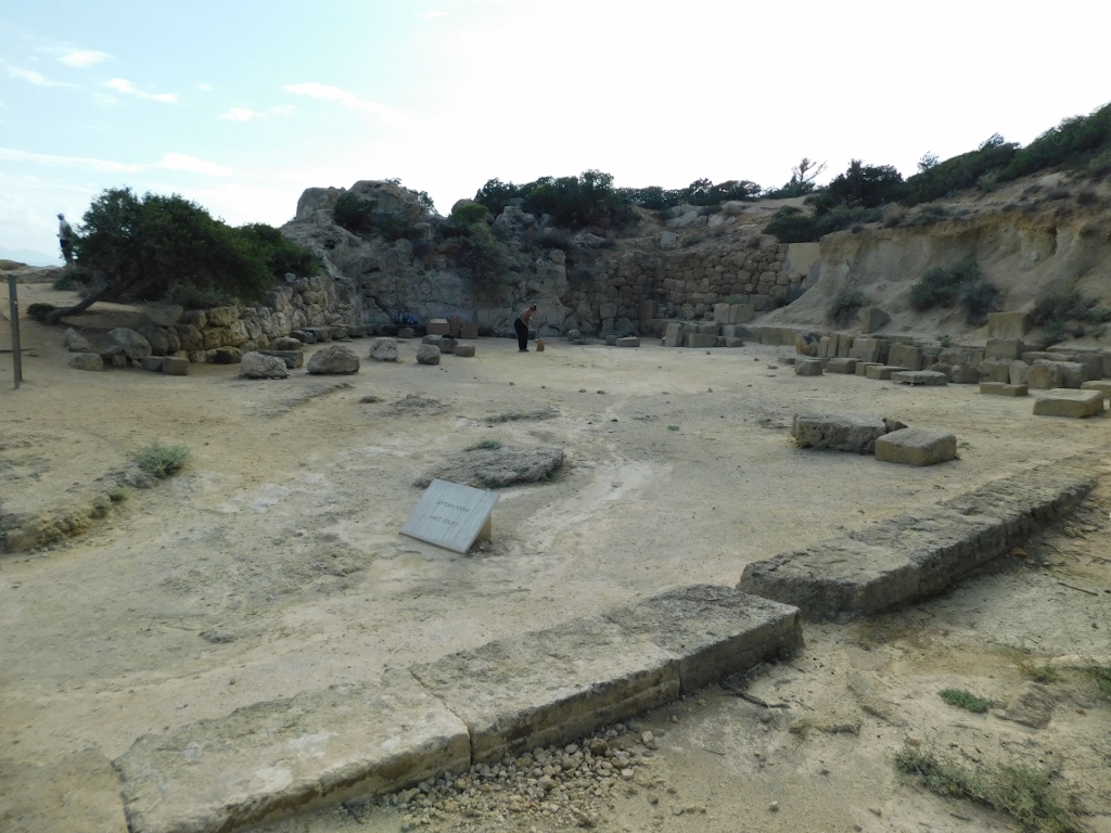 Archaeological Site of Heraion at Perachora, a detail
From here, I could also see the lighthouse.
 Archaeological Site of Heraion at Perachora, a detail
I practically finished my sightseeing of the site here, but I climbed a bit higher to get a better view of both the site and the bay, as well as the waters of the Gulf of Corinth.
 Archaeological Site of Heraion at Perachora
 Perachora peninsula, a detail
As I was climbing back to the parking lot, a few people went into the water and swam there.
 Perachora peninsula, a detail
The temperature was quite pleasant and I thought how nice it would be to go for a swim in the sea. But I must admit, I was too lazy to climb back to the car, change, go back down, then climb up again... So, I returned to the car and headed back towards Loutraki.
However, I did make a few stops along the way. The first was to check out the remains of an ancient fountain that once belonged to the sanctuary.
 Remains of an ancient fountain
And since I felt the need for a coffee, I stopped again at the western end of Lake Vouliagmeni. The coffee wasn't anything special, but the view was lovely, while the summer season was coming to an end.
 Lake Vouliagmeni in Corinthia region
 Lake Vouliagmeni in Corinthia region
By the way, this lake is connected to the waters of the Gulf of Corinth by a short canal, which I saw and photographed from the road as I was heading toward Loutraki.
 Lake Vouliagmeni in Corinthia region
A little later, I stopped at a pull-off along the road to take a photo of the town of Loutraki, where I had a hotel room booked.
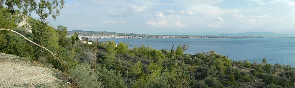 Loutraki
Loutraki is located at the south-eastern end of the Gulf of Corinth that stretches along the northern coast of the Peloponnese. It is a resort town that is also one of the largest spa towns in Greece, as it was founded in an area rich in thermal springs.
I didn’t come here to visit the spa, but just to spend the night. However, since I had some time, I decided to go for a walk.
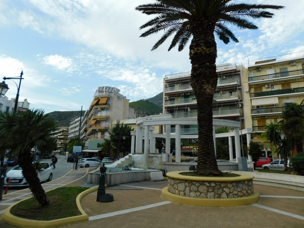 Loutraki, a detail
 Loutraki, a detail
 Loutraki, a detail
 Loutraki, a detail
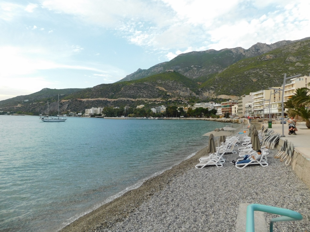
Then I felt like sitting in a café and this turned out to be a very pleasant experience.
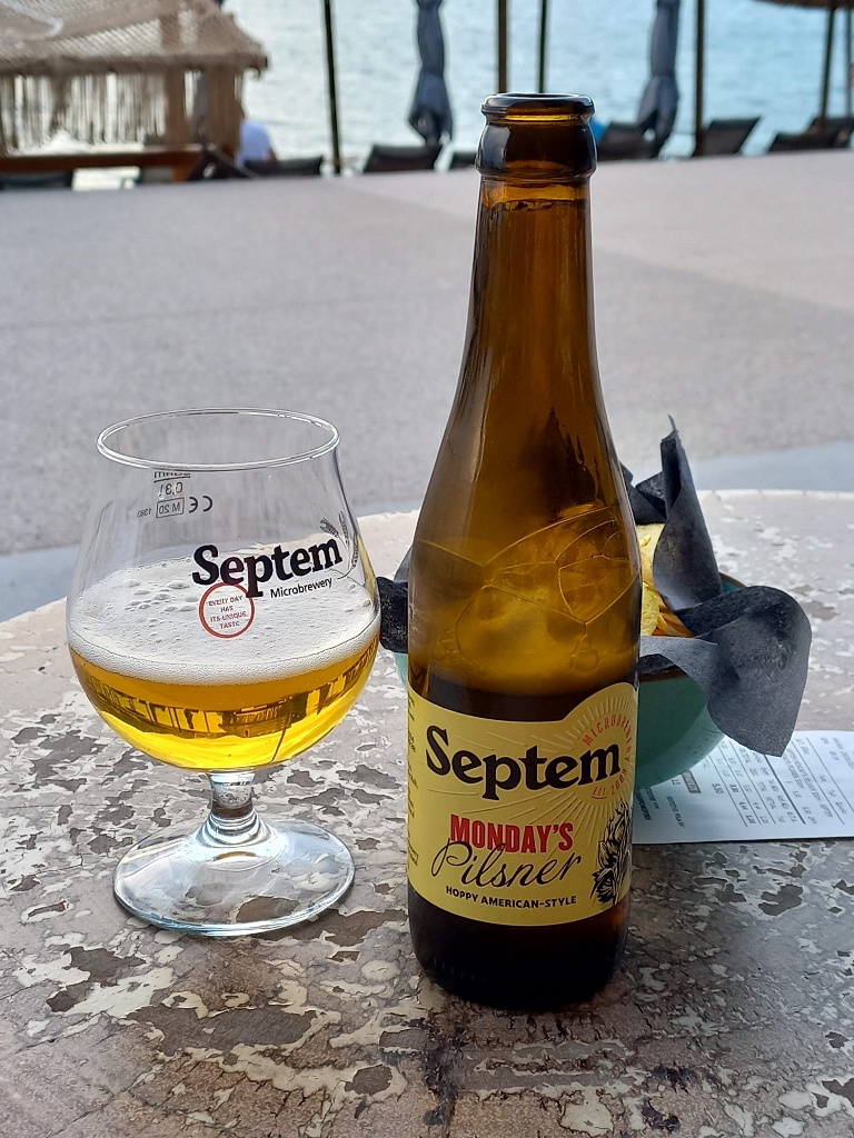 Relaxing in Loutraki
From there, I could also watch the sunset. It was all very pleasant and enjoyable, and I wasn’t the only one.
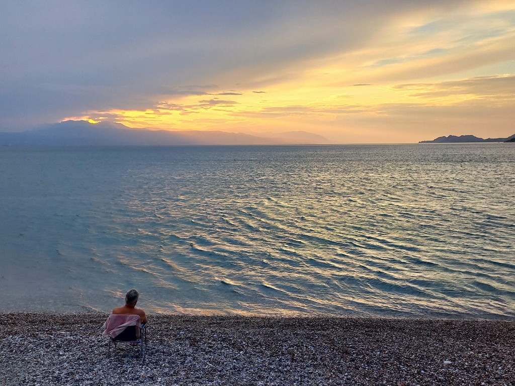 Sunset as seen from Loutraki
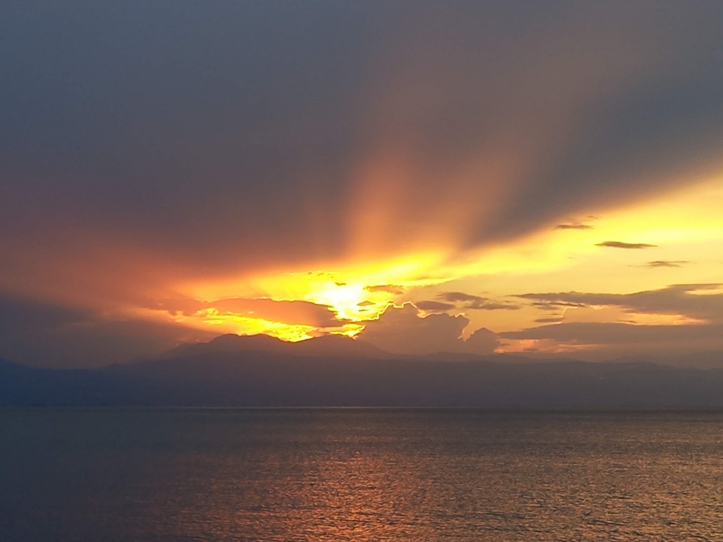 Sunset as seen from Loutraki
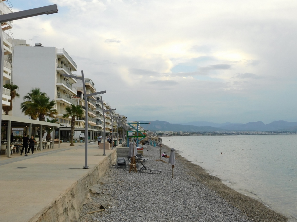
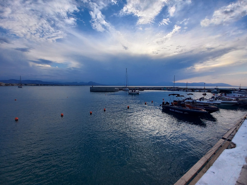
As I started to head back towards the part of the town where my hotel was, I paid more attention to the clouds hanging over parts of the Peloponnese. I wondered if any potential rain would worsen the situation with landslides and mudslides in the Vouraikos Gorge or cause problems in the gorge between Stemnitsa and Dimitsana. At the same time, I felt deeply grateful for the circumstances – or the fate – that allowed me to walk through those gorges in nice weather without any such problems.
 Loutraki, a detail
Then I went for a light dinner at a restaurant I passed by, where I had a pleasant chat with a Greek man who lives in Loutraki. However, I didn’t stay long because I wanted to get a good night’s sleep before my last full day of travelling.
Some nights feel strange even though there’s no real reason for it. That night, I dreamt a lot and the dreams weren’t bad at all – quite the opposite – but I kept waking up. And then, just before I would fall back asleep, I’d marvel at those dreams and wonder why I had interrupted them, as they seemed so wonderful.
All in all, I woke up as usual in the morning, but I knew I didn’t have to rush, so I took my time having breakfast and enjoying the coffee just the way I like it. During that time, it rained briefly, but by the time I gathered my things, got to the car and packed up, it had already stopped and it was dry from then on. I must say, I had an indescribable amount of luck with the weather during this trip. Occasionally, it got exceptionally hot, but overall it was perfect and just how I like it.
So, that morning, I left the spa and resort town of Loutraki and headed towards a monastery I had tried to visit a couple of times before. The first time, a few years ago, it was closed, probably for renovations and the second time, at the start of this trip, it was closed simply because their working hours had ended.
I wondered if the third time would be the charm.
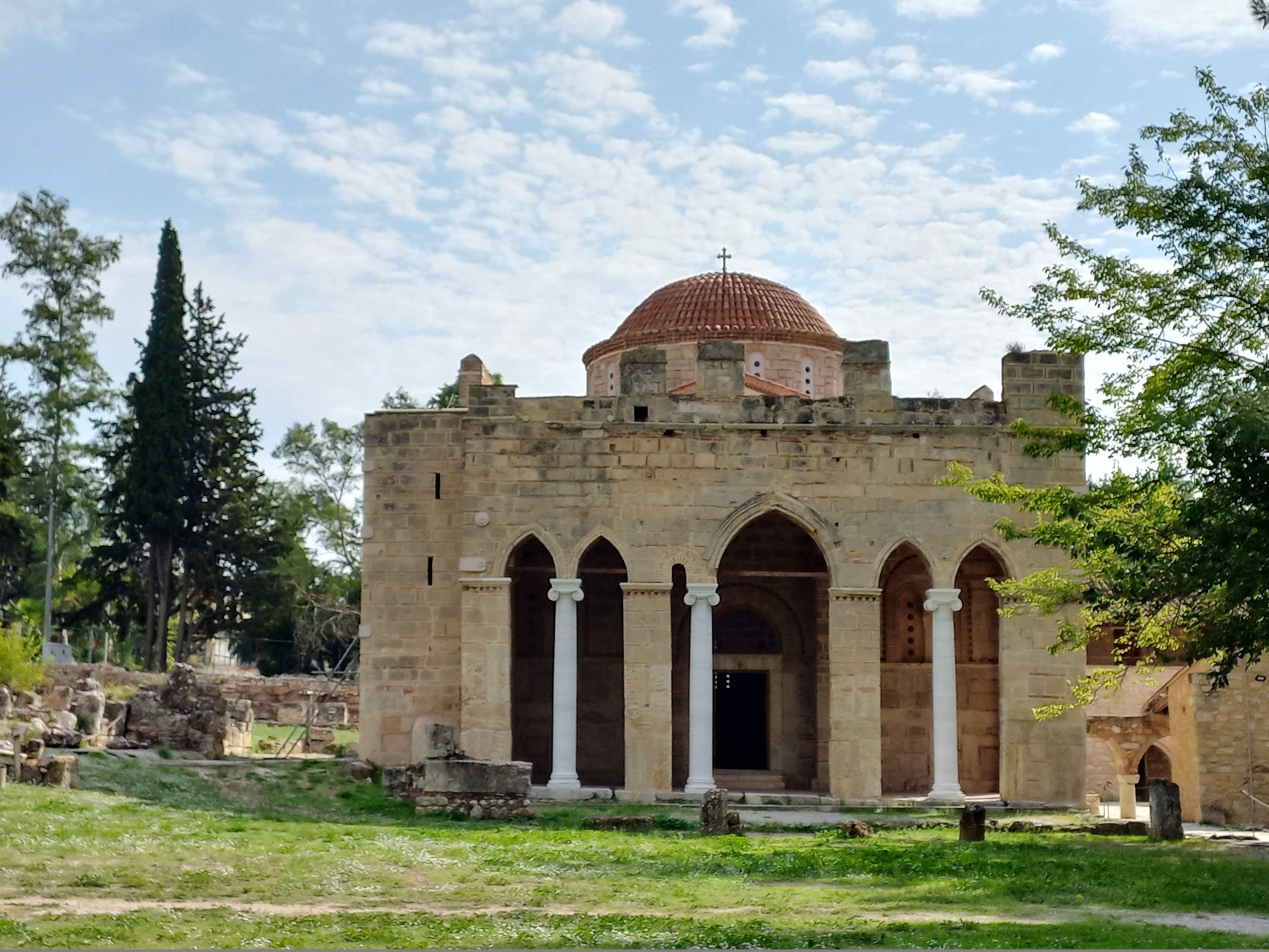
As it turned out, the monastery was open and I was extremely pleased. It is the Holy Monastery of Daphni, which is inscribed on the UNESCO World Heritage List as a part of a group of three Byzantine-era monasteries. These monasteries are located in different parts of Greece, but they share the same aesthetic characteristics.
Although the monastery complex is situated along a fairly busy road (the most direct route west from Athens), it is surrounded on all other sides by a pine forest. On the one hand, the forest provides a natural setting, but it also poses one of the potential dangers: the risk of wildfires, especially during the summer months. Another danger are potential earthquakes, with the most recent major one occurring in 1999. Fortunately, all post-earthquake interventions were carried out quickly and effectively, so the monastery continues to be an exceptionally important and beautiful place that is definitely worth visiting.
This site was once home to the Temple to Apollo, around which laurel trees grew at the time and that’s how the place got its name. "Dafni" means "laurel" in Greek and behind it is yet another ancient Greek legend. Namely, there was a nymph named Daphne, who god Apollo fell in love with (he was struck by an arrow from the god of love, Eros). However, Daphne did not want to be with Apollo, so she prayed to various gods, including her father, the river god Peneus, who transformed her into a laurel tree, dedicating it to Apollo. After that, the laurel became Apollo's favourite plant, making it all the more fitting that his temple would be surrounded by it.
But, over time, in the 5th century, a monastery dedicated to the Assumption of the Theotokos was established here, though I’m not sure when the pines replaced the laurels. Later, during a barbarian invasion, the monastery was destroyed, but it was rebuilt in the second half of the 11th century.
When the Crusaders arrived in 1205, Attica came under French control and the monastery was handed over to the order of Cistercians. In the 13th century, the church was expanded, but this all came to an end in 1458 when the Ottomans arrived. However, although the Cistercian monks left, the Ottomans allowed the monastery to remain in the hands of Orthodox monks. Interestingly, the monastery lost its religious function during the Greek War of Independence, when it was repurposed for military use. By the late 19th century, it also served as a sanitarium. Today, it is primarily an archaeological site.
Upon entering the monastery complex, the first thing you come across is the cloister that is open on the south side and resembles a paved churchyard.
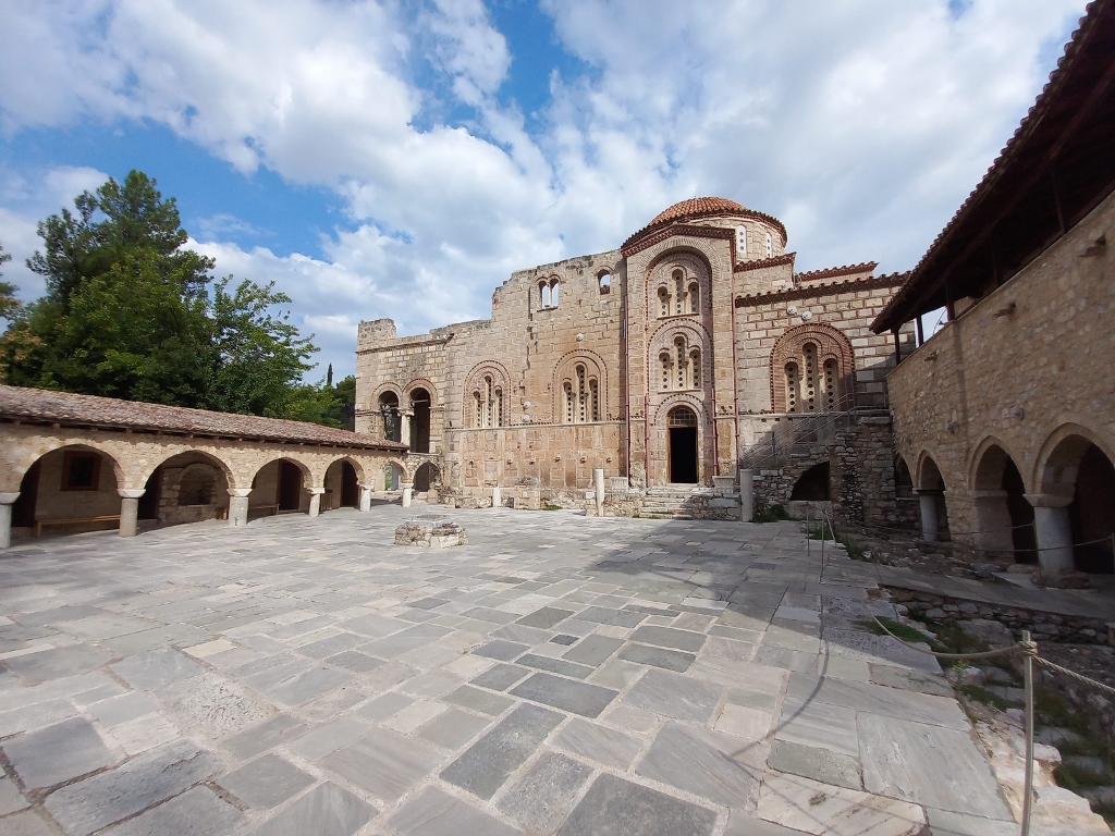 Holy Monastery of Daphni
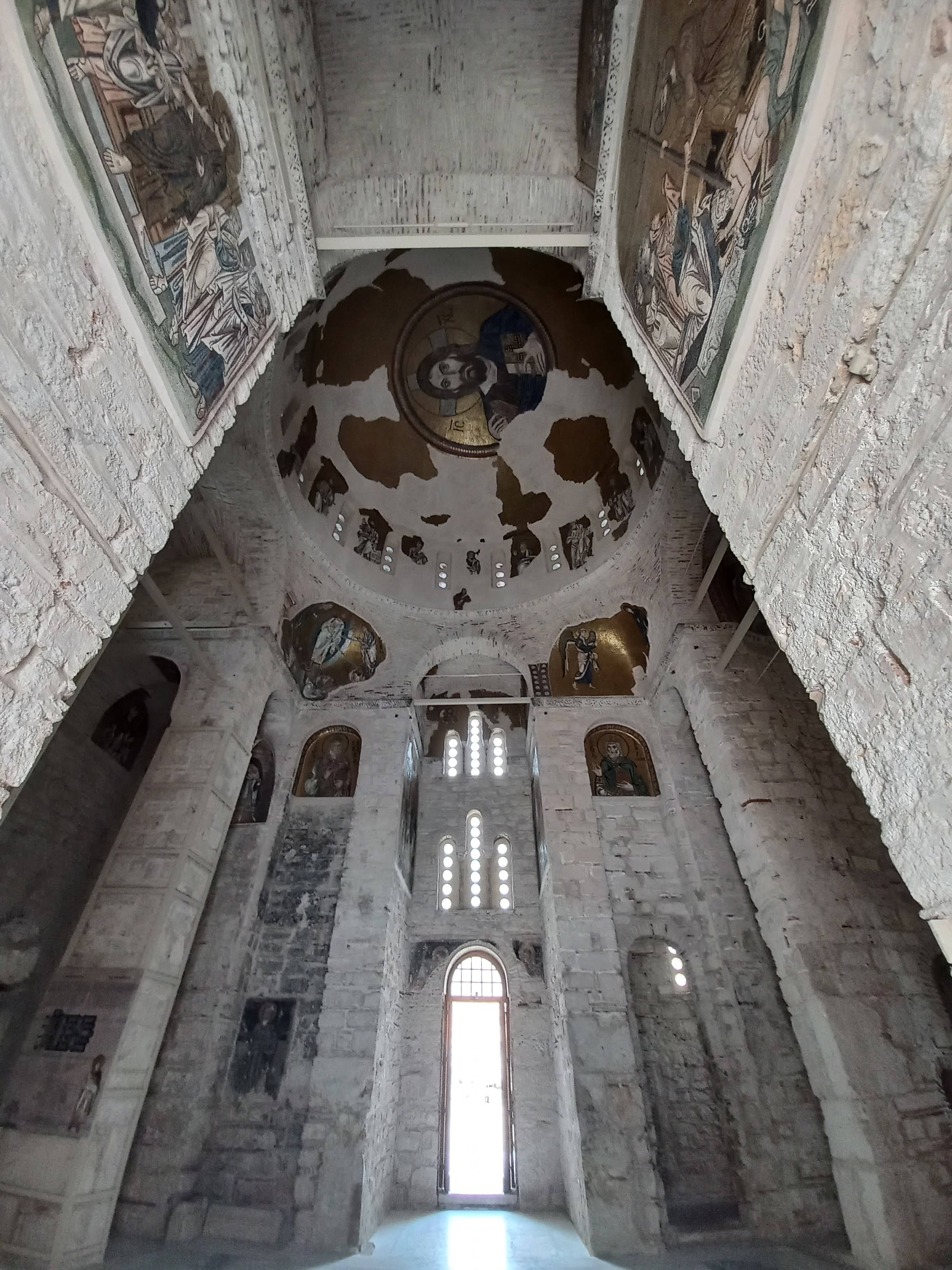
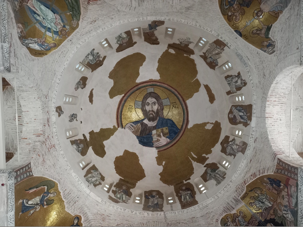
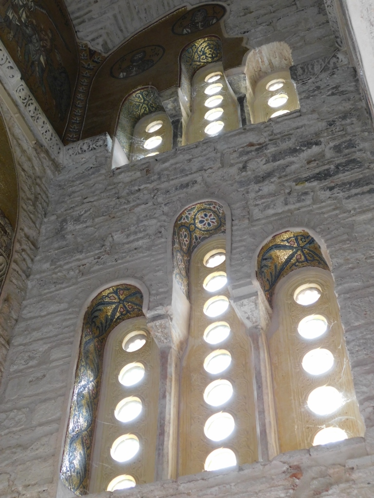
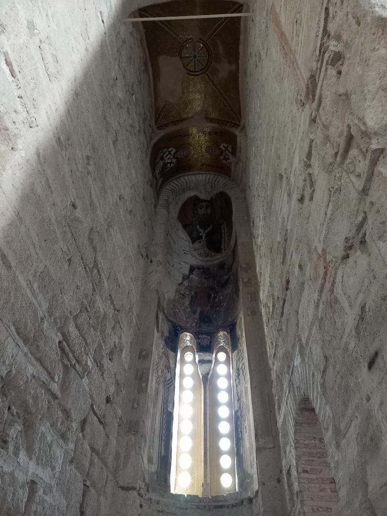
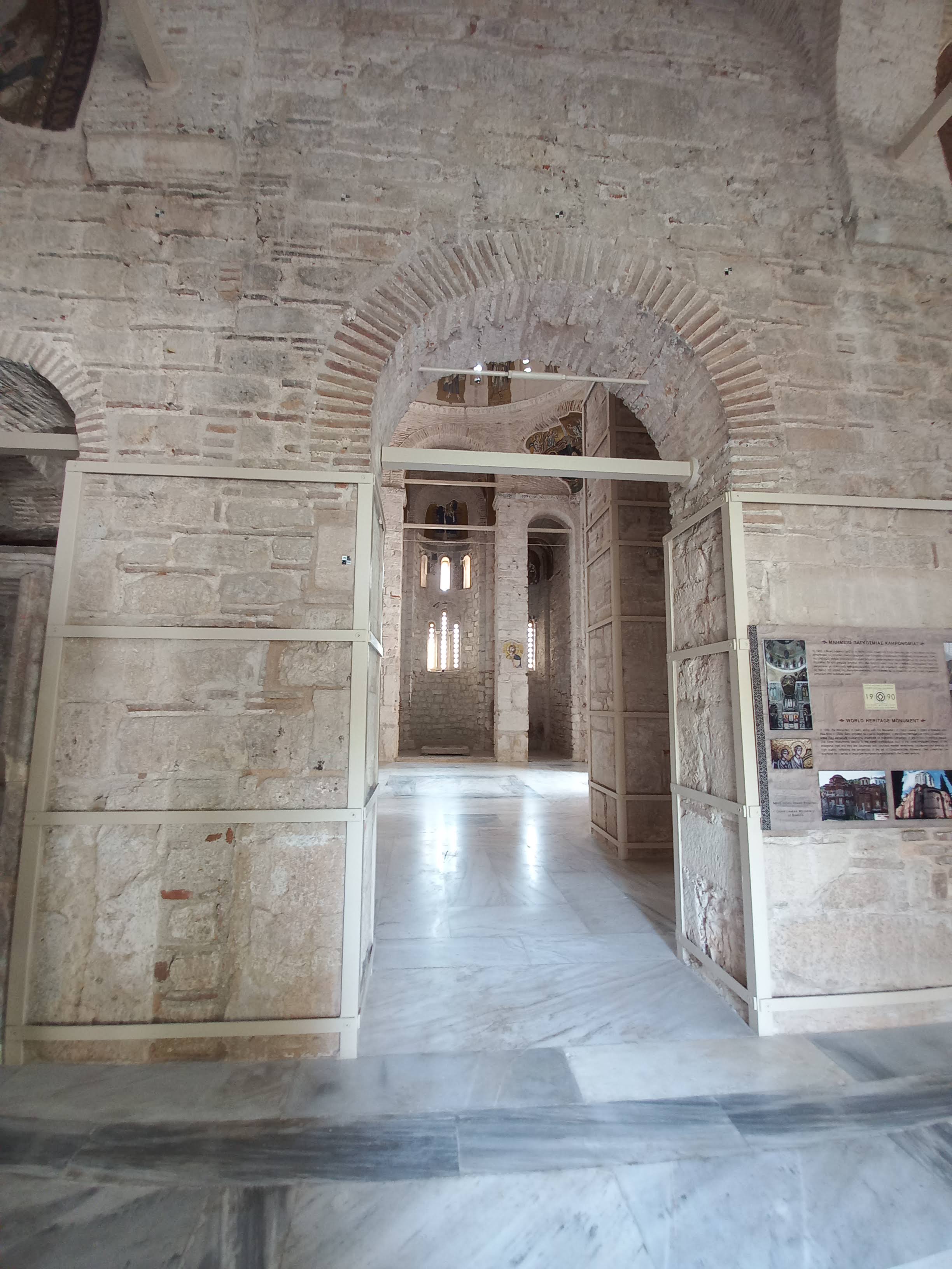
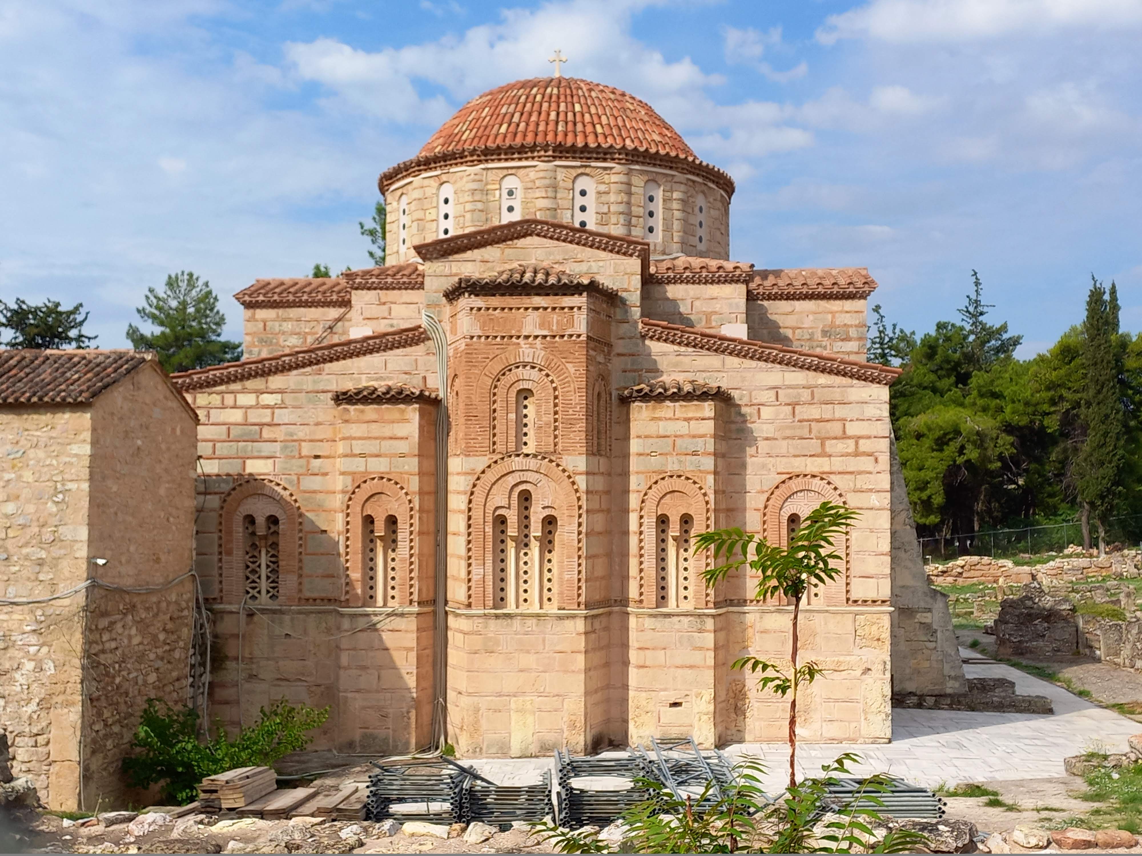
The Katholikon, or the main church, has the cross-in-square ground plan and a large dome. Despite various historical events and natural occurrences, it has managed to preserve all of its original architectural and decorative elements.
 Holy Monastery of Daphni
As for the construction, stone was used for the purpose in combination with brick, while the bricks were also employed to create decorative elements around the windows.
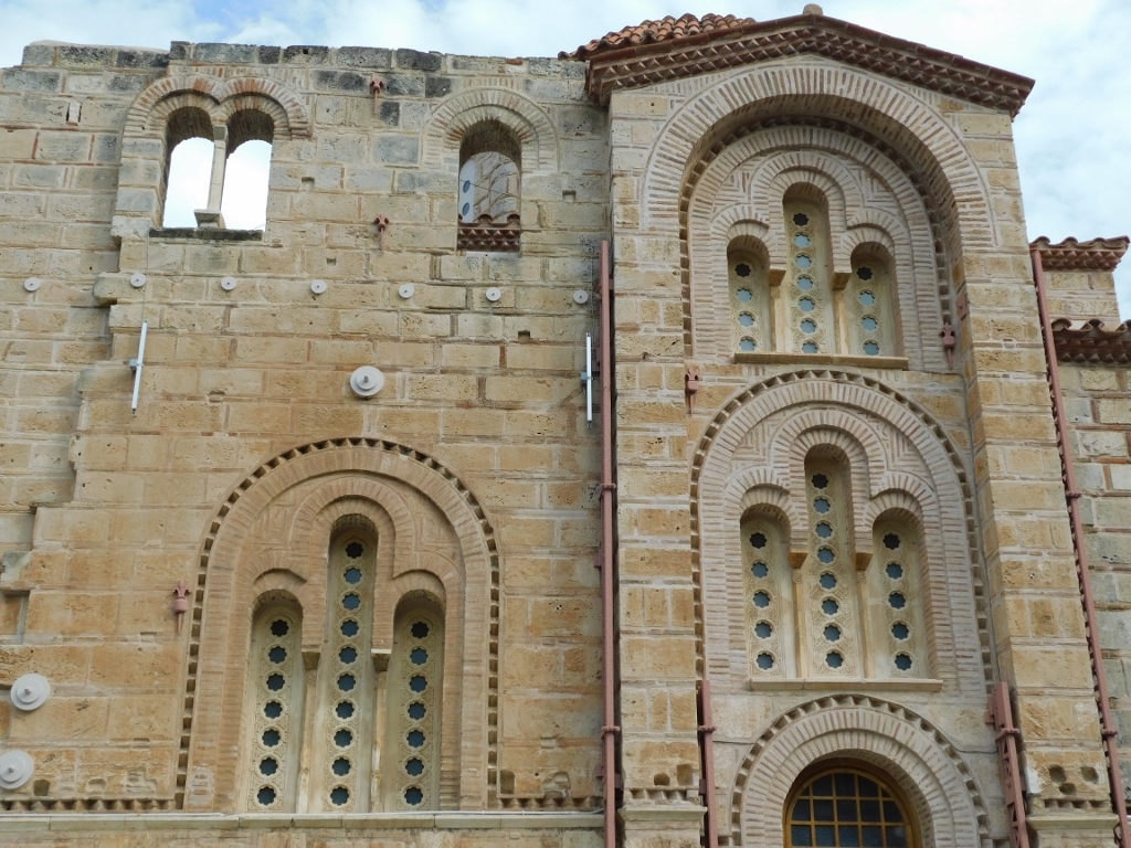 Holy Monastery of Daphni, a detail
 Holy Monastery of Daphni, a detail
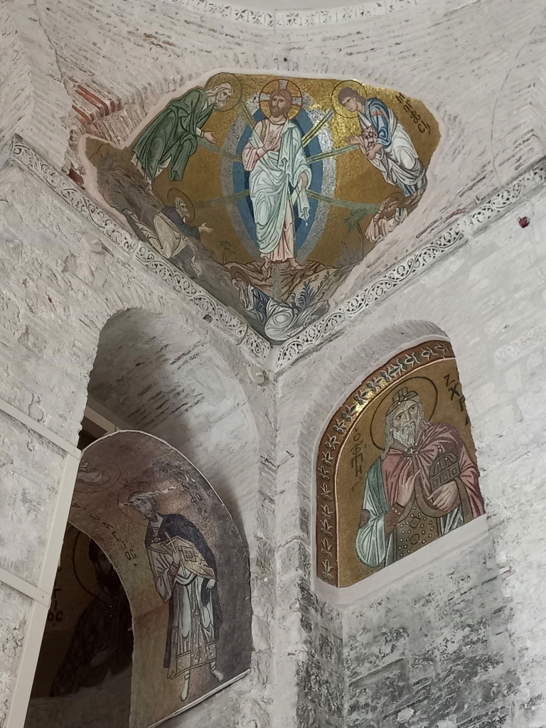
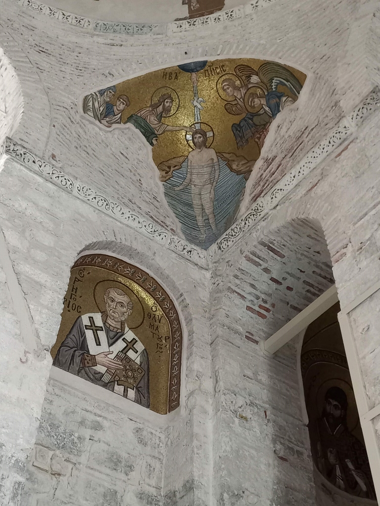
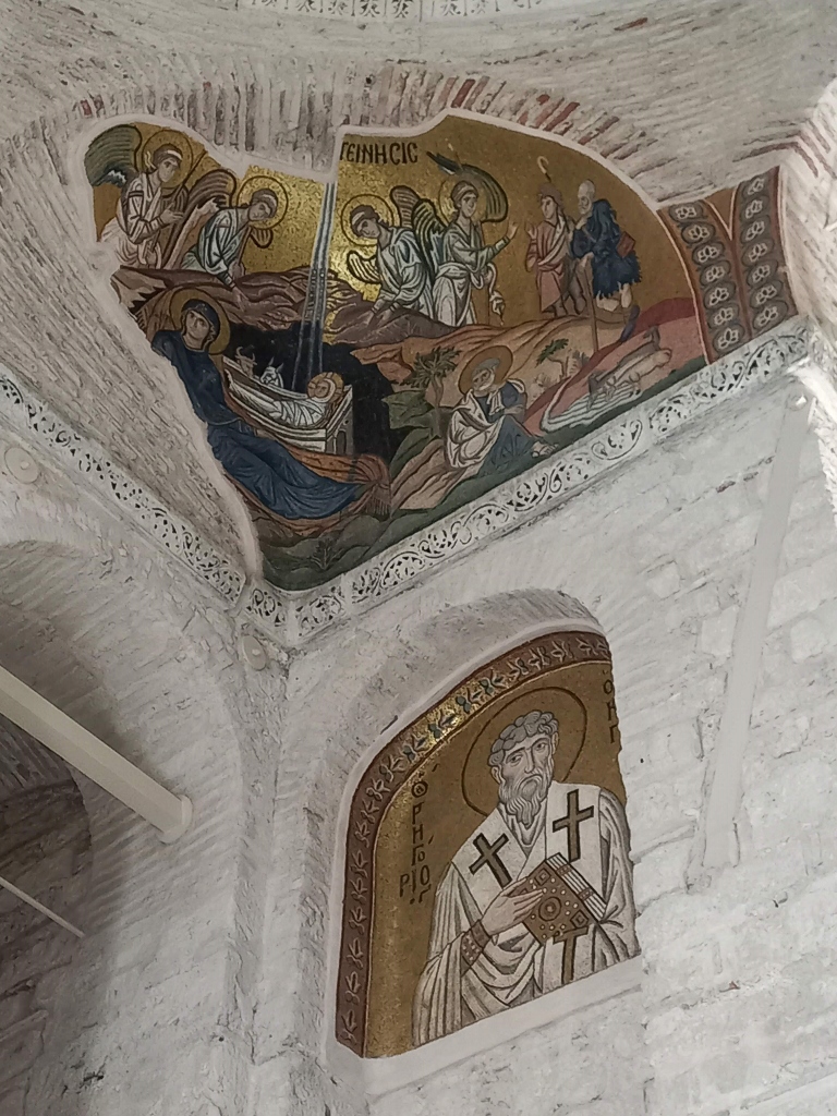
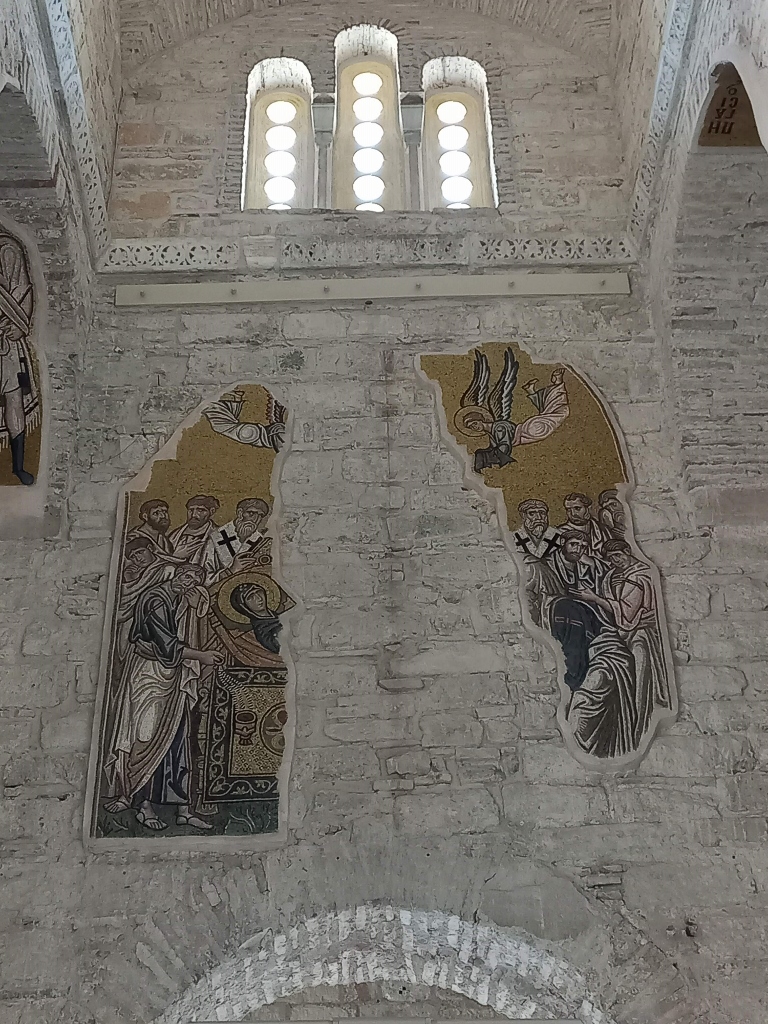
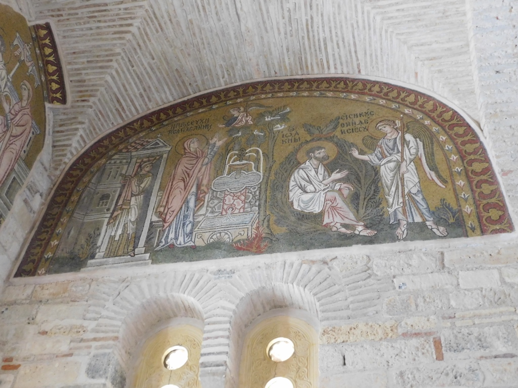
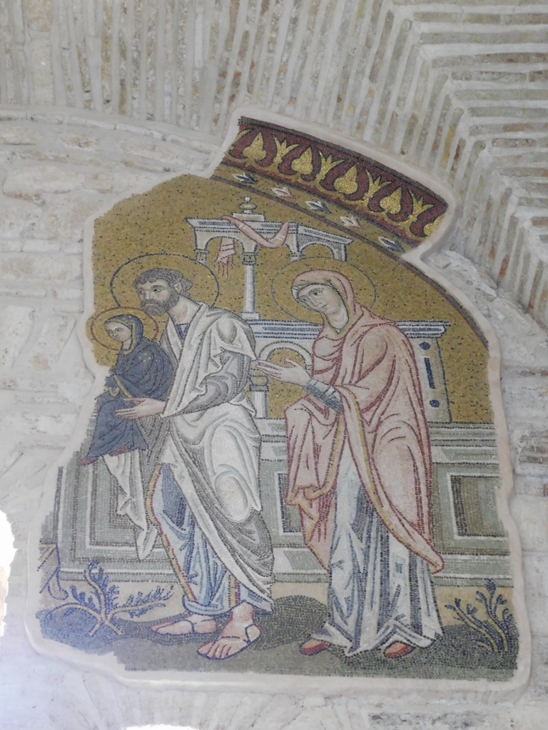
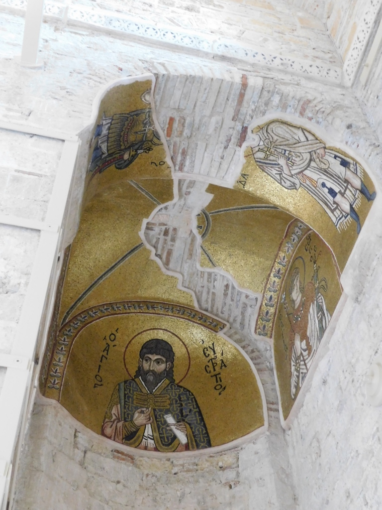
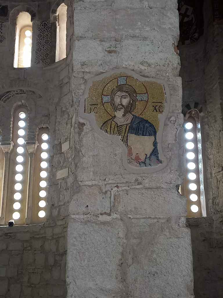
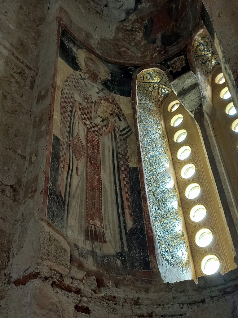
The interior decoration was done in the late 11th and 12th centuries, featuring ornamental marble pieces and exceptional wall mosaics on a golden background, which is a typical characteristic of the "second golden age of Byzantine art." Experts in religious studies and art history know exactly which mosaic depicts which scene, but I am neither that expert nor is that level of detail suitable for my travel stories. I think it's enough to let the photographs speak for themselves.
 Holy Monastery of Daphni, a detail
 Holy Monastery of Daphni, a detail
 Holy Monastery of Daphni, a detail
 Holy Monastery of Daphni, a detail
 Holy Monastery of Daphni, a detail
 Holy Monastery of Daphni, a detail
 Holy Monastery of Daphni, a detail
 Holy Monastery of Daphni, a detail
 Holy Monastery of Daphni, a detail
 Holy Monastery of Daphni, a detail
 Holy Monastery of Daphni, a detail
 Holy Monastery of Daphni, a detail
Some parts of the church are decorated with frescoes, which were most likely created in the 17th century after the marble wall decoration had deteriorated.
 Holy Monastery of Daphni, a detail
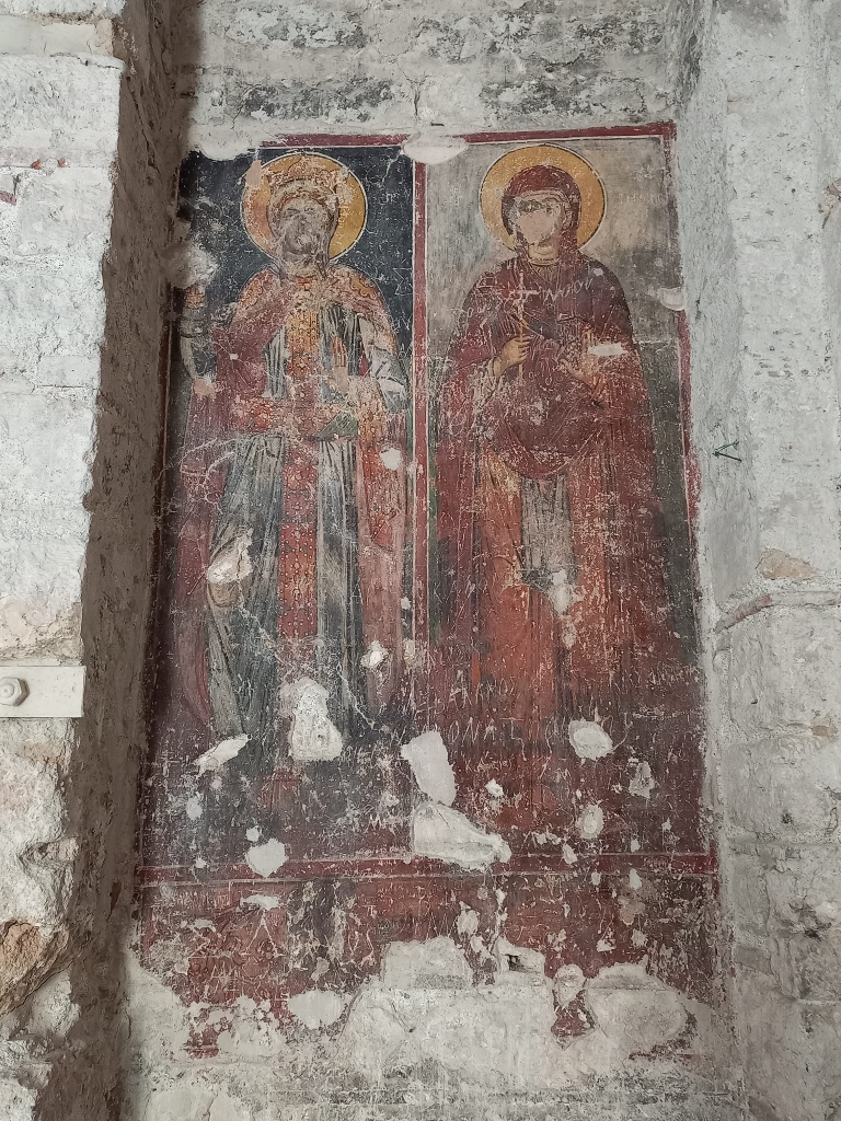 Holy Monastery of Daphni, a detail
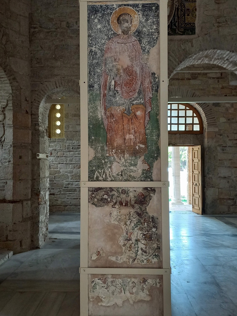 Holy Monastery of Daphni, a detail
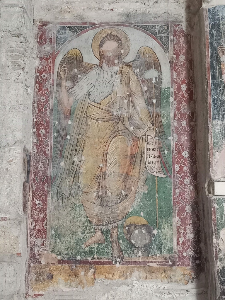 Holy Monastery of Daphni, a detail
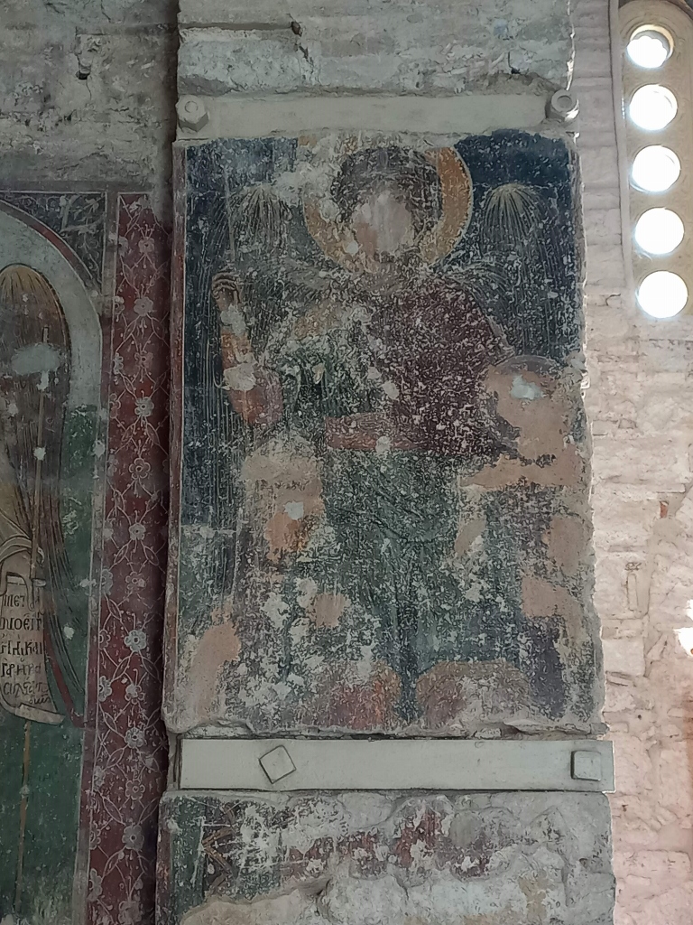 Holy Monastery of Daphni, a detail
 Holy Monastery of Daphni, a detail
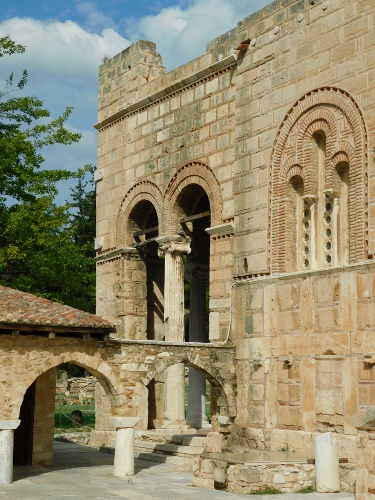
The church is entered from the south side through the courtyard, while the main entrance, of course, is from the west. There are both an internal and an external narthex, with particular architectural beauty in the external one – featuring arches and columns with antique capitals. To the north of the church there are the remains of the refectory.
 Holy Monastery of Daphni
From here, I returned to the church to get the full impression of entering the sanctuary and also to film with my video camera.
 Holy Monastery of Daphni, a detail
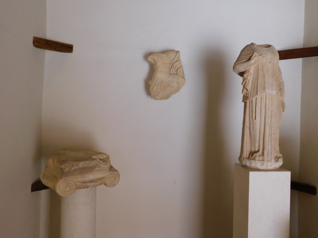
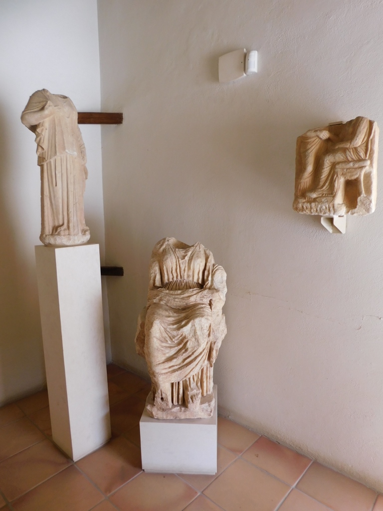
Within the monastery, there is a small exhibition space where you can see some finds from the site, dating back to the ancient Greek and Roman periods.
 Holy Monastery of Daphni, a detail
 Holy Monastery of Daphni, a detail
Finally, from the sidewalk next to the fence, I took a photo of the eastern side of the church with its apses and then, feeling extremely content I was able to continue on my way.
 Church of the Assumption of the Theotokos within the Holy Monastery of Daphni